

NYC forecast: sunshine and mild today, light snow Sunday before rain next week
Cloud coverage, near-freezing temps in NYC ahead of weekend precipitation
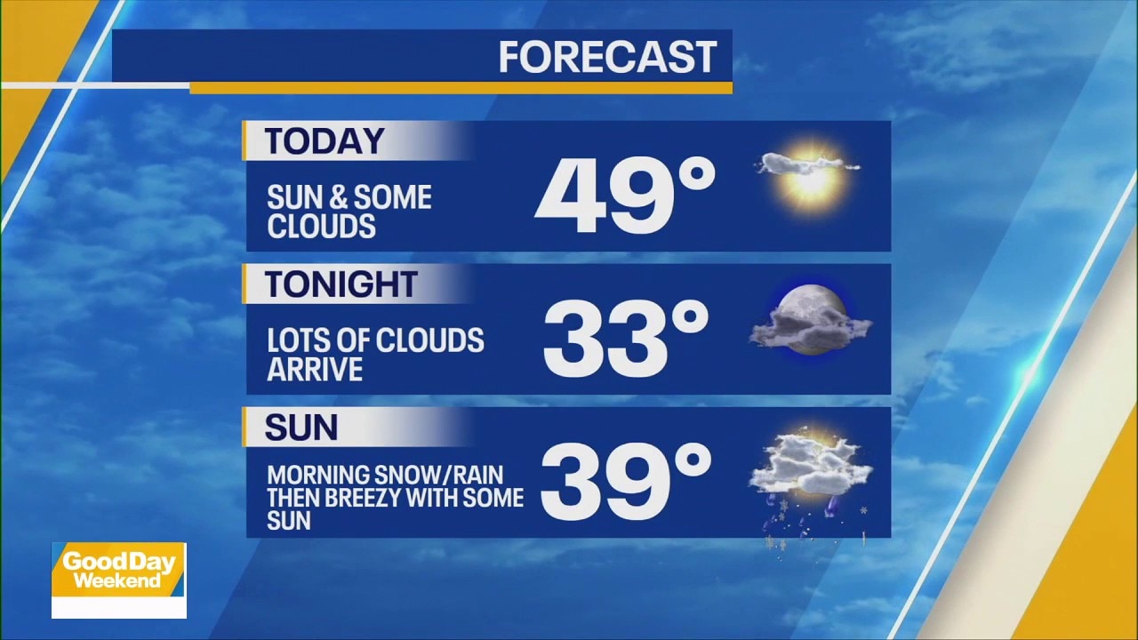
FOX 5 NY weather forecast for Feb. 28, 2026.
NEW YORK - New Yorkers will enjoy milder and sunnier conditions today, but snow showers could return Sunday as the next system moves through, followed by a wetter period early next week.
Milder day with sunshine
After a wintry start earlier this week and residual snow on the ground, the forecast for Saturday in New York City calls for sunshine and milder air, with highs climbing near 50 degrees in Manhattan. This pleasant day will help continue snowmelt from the significant storm that recently impacted the region.
Lows tonight will dip into the 30s, and patchy fog or isolated areas of black ice are possible early Sunday morning before the next disturbance arrives.
Light snow possible Sunday
A cold front and a narrow band of moisture moving through the Northeast Sunday could bring light snow showers across the NYC metro area, particularly late morning into the afternoon.
The National Weather Service indicates that snow showers are likely Sunday, with most precipitation staying light and brief. Any accumulations would be minimal given temperatures near freezing and above during much of the event.
At this time, no advisories are anticipated, and impacts are expected to be limited as moisture exits by late Sunday.

Transition to rain and unsettled early week
After the Sunday snow, the forecast pattern shifts as multiple weak waves of low pressure move nearby early next week. Forecast discussion from the National Weather Service notes that precipitation Tuesday through Friday will mainly be rain, with only brief snow or mix possible near the coast and interior before warmer air arrives.
This pattern contrasts with earlier higher-impact storm talk for next week, as the current outlook favors little to no impactful snow next week and a quicker transition to rain with rising temperatures.
Forecast shift: less snow than earlier expected
Earlier in the week, forecast models hinted at the potential for a more impactful winter storm affecting the Tri-State area next week. However, updated guidance from the National Weather Service now shows a weaker pattern, with Sunday’s snow expected to be light and early next week trending more toward rain than significant accumulation.
While small shifts in storm track are still possible, the current outlook does not indicate a major winter storm for New York City at this time.
What to watch
According to the National Weather Service, New York:
- Fog early Sunday morning and possible slick spots on untreated surfaces.
- Light snow Sunday with little accumulation at most locations.
- Rain transition early next week with warmer air taking hold.
The Source: This article was written using forecast information from the National Weather Service and FOX 5 NY meteorologists.