

NYC area braces for more severe storms, flash flooding l Rain timeline
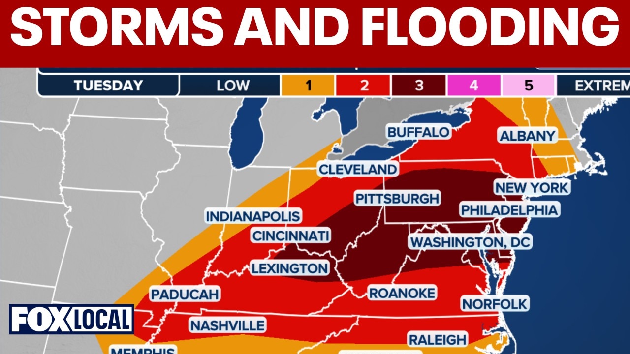
Severe storms, flash floods threaten NYC area Tuesday
The Tri-State region is facing a turbulent weather day as more severe weather is expected to roll in on Tuesday.
NEW YORK CITY - New York City is facing a turbulent weather day as another round of severe weather threatens the Tri-state area with more rain and flooding risk on Tuesday.
- MORE: LIVE weather updates: Tornado warnings in Passaic, Somerset, Sullivan counties
- MORE: Heavy storms, severe flooding threaten NYC evening commute as flood watch issued
Timeline:
Tuesday's quiet morning commute will take a turn in the late morning hours, reaching a peak during the afternoon and evening commute. Here's the timeline for the day's severe weather:
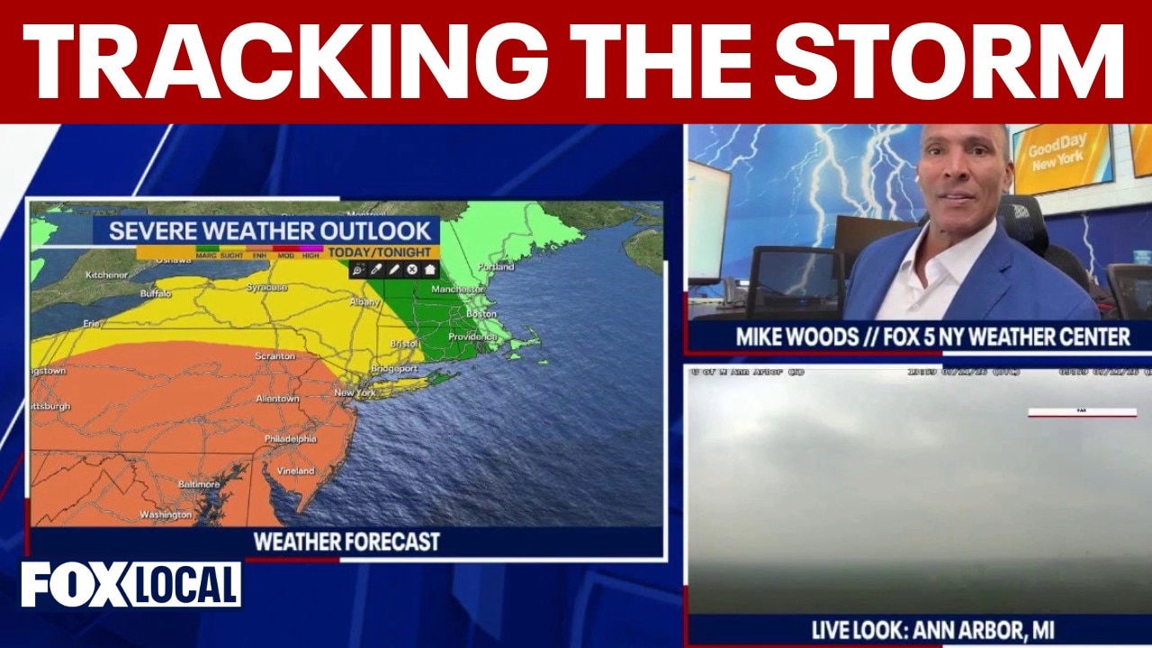
NYC region under flood watch as severe storm system tracks east
A slow-moving storm system tracking from the Midwest is headed straight for the New York, New Jersey, and Connecticut regions. FOX 5's Mike Woods warn of a potential "one-two punch" of severe weather, with heavy rain rates of 1 to 2.5 inches per hour expected during the afternoon and evening commute.
- Morning conditions: Early showers are crossing over from Pennsylvania into Sussex, Warren, and Hunterdon counties. Rain will remain light to moderate early on, with a brief window of relatively quiet weather during the mid-to-late morning hours.
- Late-morning transition (10 to 11 a.m.): Storm development risks begin to rise rapidly, starting southwest of the region and spreading northeast over the Tri-State area.
- Afternoon and evening commute: The most impactful weather hits during the afternoon and evening commute. Heavy downpours, strong to severe thunderstorms, damaging wind gusts, localized hail, and isolated tornadoes are all possible.
- Wednesday: Severe weather risks drop back down to a marginal risk tier across the board, making today the primary event.
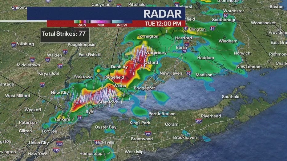
Weather advisories
What we know:
The National Weather Service has issued several active alerts and advisories as multiple rounds of heavy downpours and severe thunderstorms impact the region.
A flood watch is in effect until 2 a.m. Wednesday for Northeast New Jersey, the NYC metro area, and surrounding low-lying communities, where rainfall totals are expected to average 1 to 2 inches, with localized totals reaching 3 to 4 inches at rapid rates of up to 2.5 inches per hour.
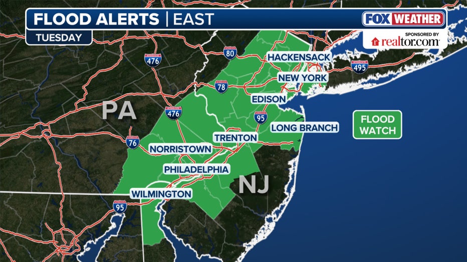
Tuesday flood alerts (FOX Weather)
In addition to flooding, severe thunderstorm threats cover much of the Tri-State area. Northeast New Jersey and the immediate NYC metro face the highest risk levels, categorized between a Level 2 and Level 3 severe weather risk.
The primary threat includes damaging wind gusts of 60 to 70 mph capable of downing trees and power lines, along with large hail up to 1 inch in diameter. Forecast models also indicate an isolated tornado threat, particularly across Northeast New Jersey, the NYC metro, Nassau County, and the Lower Hudson Valley.
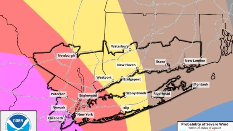
Photo credit: The National Weather Service.
Meanwhile, coastal areas face additional hazards, with dangerous rip currents expected at all ocean beaches through Wednesday.
Share your storm photos here
The Source: Information from this article was sourced from the National Weather Service and the FOX 5 Weather Team.