

Severe thunderstorm watch issued as heat wave continues across NYC area
Credit: NOAA
NEW YORK - New Yorkers are still sweltering under a heat advisory that will last into Sunday evening, but a line of storms could potentially bring severe storms and even the threat of tornadoes to some parts of the region.
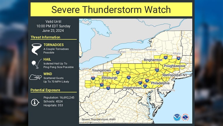
According to the National Weather Service, a severe thunderstorm watch has been issued for areas of the Lower Hudson Valley, including Ulster, Dutchess, Orange, and Putnam counties until 10:00 p.m. tonight. The warning also covers Fairfield County in Connecticut and pars of northwestern New Jersey.
The storms bring the threat of hail, wind gusts of up to 70 mph, and the possibility of tornadoes.
Severe thunderstorms are officially defined as storms that are capable of producing hail that is an inch or larger or wind gusts over 58 mph.
At that size, hail can damage property like roofs and vehicles, while wind that strong can break off large branches or even knock down trees.
The NYC area is already under a heat advisory until 8 p.m. tonight, with temperatures expected to reach as high as 100-104 degrees in some places.
The storms are expected to clear overnight, leaving us with a mostly sunny Monday with high temperatures around 85.