

Wintry mix possible Thursday as forecasters eye another potential snowstorm next week
Another NYC snowstorm next week!? Early thoughts
FOX 5 NY's Mike Woods joins Dan Bowens on Newsroom Live to talk about the potential for another snowstorm next week.
NEW YORK CITY - Just days after a historic snowstorm buried parts of the Tri-State area, another round of weather could bring a wintry mix Thursday, with yet another potential storm looming next week.
- Stay connected with FOX LOCAL. For 24/7 winter storm coverage—Download Now.
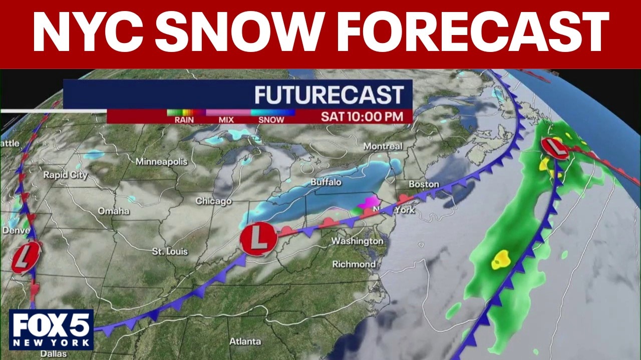
Thursday weather
What we know:
Weather forecast models show a developing storm system that could spread precipitation into the Northeast on Thursday, with the potential for a wintry mix, including snow, sleet and scattered freezing rain, in the Tri-State area. The exact timing and intensity will depend on how the system tracks as it moves eastward.
FOX weather live updates
Meteorologists say that cold air remains entrenched over the Northeast following a historic winter storm, meaning snow or mixed precipitation is more likely than rain if temperatures stay near or below freezing.
When could the wintry mix hit?
Timeline:
Forecasters say the precipitation associated with Thursday’s system is expected to spread from the Midwest into the Northeast later Wednesday and Thursday.

The overview for the second round of snow occurring later in the week (FOX Weather)
In the NYC metro area, this could start as a mix of snow and sleet before ending later in the day. Travel during the Thursday morning and evening commutes could be affected if the wintry mix materializes.
Is there another snowstorm coming?
What's next:
Longer-range forecast guidance shows potential for another winter storm early next week. Some computer models project a storm tracking across the Midwest and into the Northeast, with enough cold air in place for snow accumulations in parts of Connecticut and other nearby states.

The possible amount of snow in the north. (FOX Weather)
In some scenarios, this could mean several inches of snow, possibly 6 to 12 inches in southern New England, but other model tracks suggest the storm could shift south and yield more rain or ice instead.
What we don't know:
Forecasters say confidence in the details is low this far out and residents should follow updates as the pattern evolves. Snow or mixed wintry precipitation can continue to impact travel if the system materializes as some models currently indicate.
Stay ahead of the snow with FOX 5’s expert meteorologists, streaming LIVE on FOX LOCAL. We’re streaming nonstop coverage with the newest forecasts, snow potential, and preparation tips. Download FOX LOCAL for 24/7 weather coverage on your smart TV and mobile devices.
The Source: This article was written using forecast information from the FOX Forecast Center and regional models, as reported by FOX Weather.