

Snow storm forecast: When will snow return in NY, NJ and CT?

NYC weather forecast
After one storm comes another. When will snow return to our area? FOX 5 NY's Audrey Puente has your weather forecast.
NEW YORK CITY - Track the latest NYC snow forecast here.
As one winter storm bringing snow and ice moves out of the New York City area, another is set to impact parts of New York, New Jersey, and Connecticut next week.
The FOX Forecast Center said at least three separate winter storms are expected to sweep across a large portion of the U.S. during the week ahead, bringing the threat of widespread snow and ice to tens, if not hundreds, of millions of Americans from coast to coast.
When will we see snow next week?
What we know:
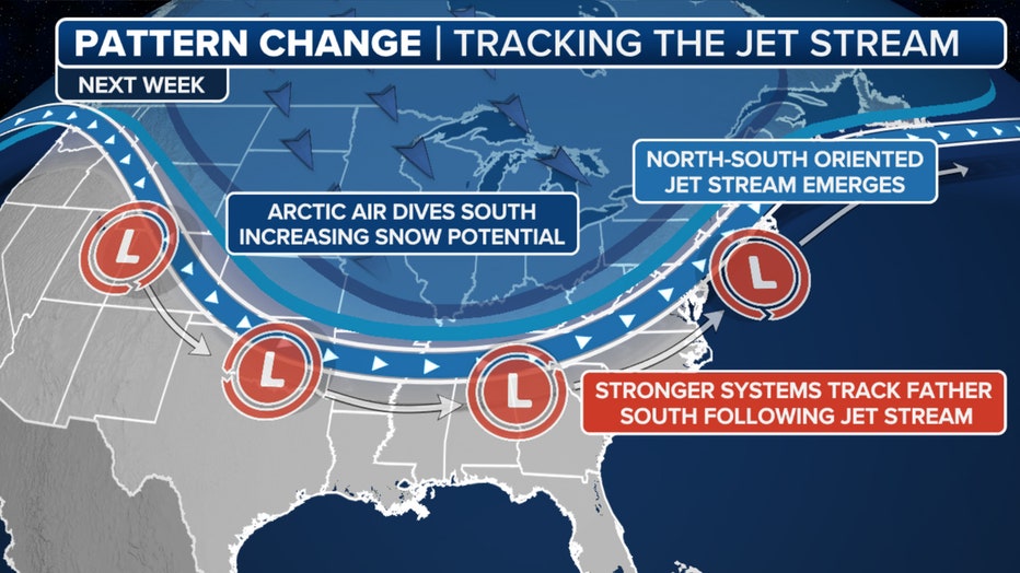
Next week has many more chances for snow in New York City as forecast models show a change in the jet stream pattern.
"As we go into Tuesday night, that's when we start to see our weather patterns shift just a bit," FOX 5 NY's Audrey Puente said. "There's actually a system that's actually going to pass to our south, but we are going to be on the northern fringe of it."
Overall weather pattern for 2/10/2025 (FOX Weather)
According to FOX Weather, New York City is potentially seeing double-digit totals from storm systems that will impact the region from Monday, Feb. 10 to Monday, Feb. 17.
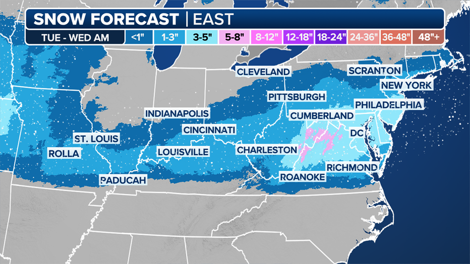
This graphic shows the forecast snow totals on Monday, Feb. 10, and Tuesday, Feb. 11, 2025. (FOX Weather)
The first of three winter storms is expected to develop right at the start of the new workweek on Monday over the Plains, and preparations are underway in the region.
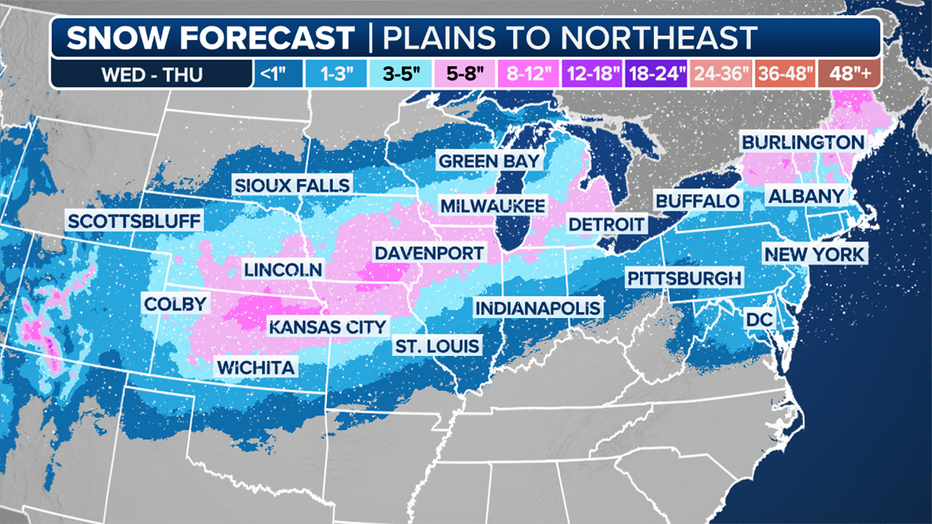
This graphic shows the snow potential on Wednesday, Feb. 12, and Thursday, Feb. 13, 2025. (FOX Weather)
After impacting the Plains, the storm is expected to move into the Ohio Valley on Tuesday, and then slam the mid-Atlantic and portions of the Northeast from Tuesday night into Wednesday morning before moving offshore.
As that first storm begins to wind down over the mid-Atlantic and Northeast on Wednesday, the second storm will already be developing over the Plains.
The FOX Forecast Center said the storm will spread snow into the Midwest by Wednesday night before setting its sights on the Northeast on Thursday.
The National Weather Service has already forewarned portions of New Jersey with a winter storm watch which goes into effect Tuesday afternoon and will last until Wednesday afternoon.
The last storm, for now, is expected to take shape late this week and continue into the weekend, bringing yet another round of winter weather to cities from the Plains to New England.
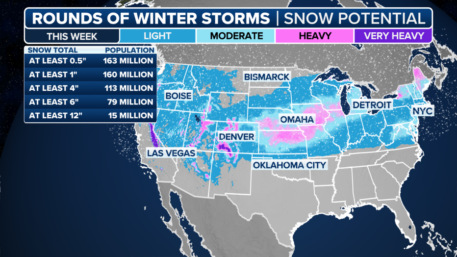
This graphic shows the snow potential across the U.S. (FOX Weather)
What we don't know:
Exact snowfall amounts are still being fine-tuned, so uncertainty in the track and precipitation type for each system still remains.

The country’s active weather pattern is expected to continue throughout most of the month, with no relief in sight for the nation's heartland through the East Coast.
NYC weather forecast
Forecast for the week:
- Monday: Sunny, with a high near 35.
- Monday night: Partly cloudy, with a low around 25.
- Tuesday: 40% chance of snow after 1 p.m. Cloudy, with a high near 35.
- Tuesday night: Snow likely, mainly before 1am. Mostly cloudy, with a low around 28. Chance of precipitation is 60%. New snow accumulation of less than one inch possible.
- Wednesday: Partly sunny, with a high near 35.
- Wednesday night: A chance of snow before 1 a.m., then snow and sleet. Chance of precipitation is 90%.
- Thursday: Rain, mainly before 1 p.m. High near 41. Chance of precipitation is 90%.
- Thursday night: Mostly cloudy, with a low around 29.
- Friday: Mostly sunny, with a high near 37.
- Friday Night: Mostly cloudy, with a low around 27.
- Saturday: Chance of rain and snow. Mostly cloudy, with a high near 38. Chance of precipitation is 50%.
NYC weather radar
Click HERE for more information.