

Snow, below-zero wind chills expected for NYC area this weekend: See latest forecast
How much snow can New York City expect on Friday?
FOX 5 NY's Liv Johnson joins Newsroom Live to discuss the potential for snow on Friday in New York City.
NEW YORK - A fast-moving winter system is expected to bring snow to the New York City area this weekend, followed by a blast of arctic cold.
What we know:
The National Weather Service has issued an extreme cold watch for New York City from Saturday evening into Sunday afternoon.
SKIP TO: Timeline | Inches | Temperatures | Live weather
When will it snow?

Timeline:
The fast-moving system is expected to produce most of its snowfall overnight into Saturday morning, with the potential for brief snow squalls that could quickly reduce visibility and lead to short-term accumulations.
Despite sunshine Friday afternoon, temperatures will remain below freezing, with highs near 30 degrees in New York City and along the Jersey Shore and mid to upper 20s elsewhere, according to FOX 5 NY's Liv Johnson.
Snow is expected to arrive late Friday night, followed by sharply colder air.
Highs are forecast to reach only about 20 degrees Saturday and near 19 degrees Sunday, with increasing winds throughout the weekend adding to the bitter cold.
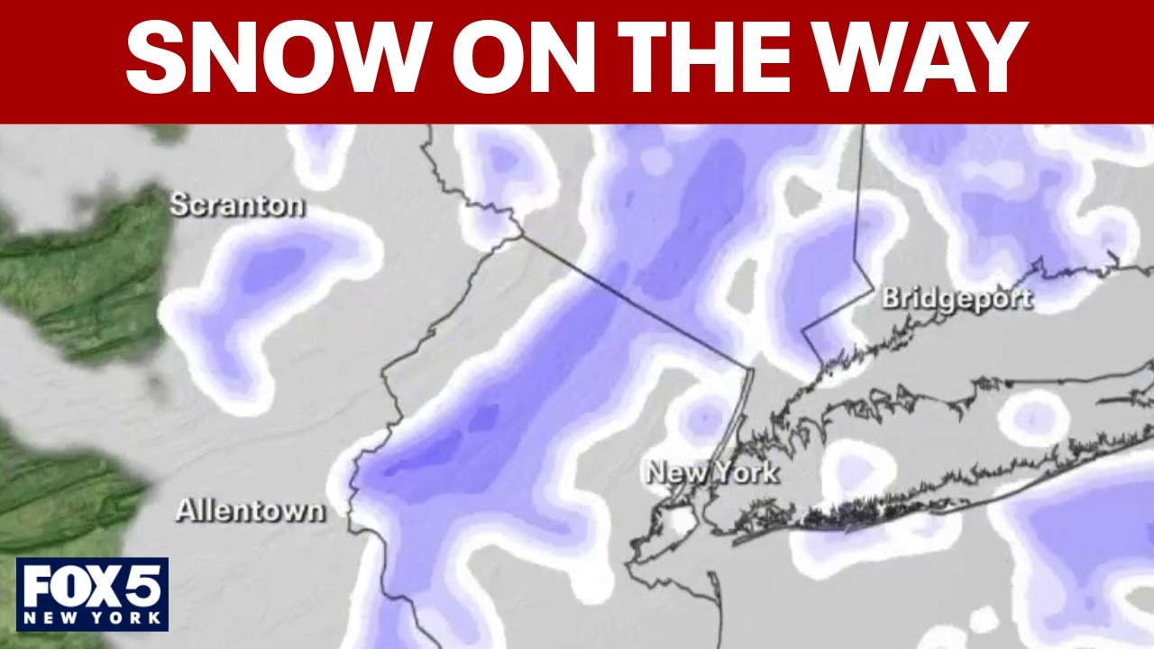
How much snow is expected?

This graphic shows forecasted snow totals through Saturday, Feb. 7, 2026. (FOX Weather / FOX Weather)
By the numbers:
Snow totals are expected to remain relatively minor, though amounts will vary by location.
The National Weather Service is forecasting about a half-inch of snow in the Lower Hudson Valley, with up to 2 inches possible near Montauk Point.
The FOX Forecast Center said New York City could see an additional 1 to 3 inches of snow as the fast-moving clipper system tracks through the region.
Upstate New York could also see snow squalls, where brief bursts of snow may lead to rapidly changing road conditions.
Cold weather: Wind chills below zero

This graphic shows peak wind gusts expected through Saturday. (FOX Weather / FOX Weather)
Why you should care:
Another blast of arctic air is expected to settle in over the weekend, bringing frigid temperatures and hazardous wind chills, forecasters said.
The National Weather Service said wind chills could drop well below zero Saturday into Sunday, with the coldest conditions expected Saturday night into Sunday morning.
Wind chills could reach minus 20 to minus 25 degrees inland and minus 10 to minus 20 degrees elsewhere.
7-day forecast

What you can do:
Officials urged residents to limit time outdoors, dress in layers and take precautions to protect pets, pipes and vulnerable populations as the extreme cold moves in.
FOX Weather live updates
Stay ahead of the snow with FOX 5’s expert meteorologists, streaming LIVE on FOX LOCAL. We’re streaming nonstop coverage with the newest forecasts, snow potential, and preparation tips—before the storm and all weekend long. Download FOX LOCAL for 24/7 weather coverage on your smart TV and mobile devices.
The Source: This report is based on information from the National Weather Service, FOX Weather and FOX 5 NY's Liv Johnson.