

Tornado watch issued for parts of NJ as rain, wind slam Tri-State l Latest storm forecast
Tornado watch issued for parts of NJ: Forecast
FOX 5 NY's Audrey Puente joins Lisa Evers on Newsroom Live to discuss the timing and impacts of Monday's potential for severe weather in New York City.
NEW YORK CITY - A powerful storm system is soaking the Tri-State area on Monday, potentially creating a messy commute with periods of heavy rain, strong winds and the chance for a few thunderstorms. Forecasters say the worst conditions could arrive during the evening commute, when heavier downpours and stronger wind gusts are expected.
Tornado watch NJ today
What we know:
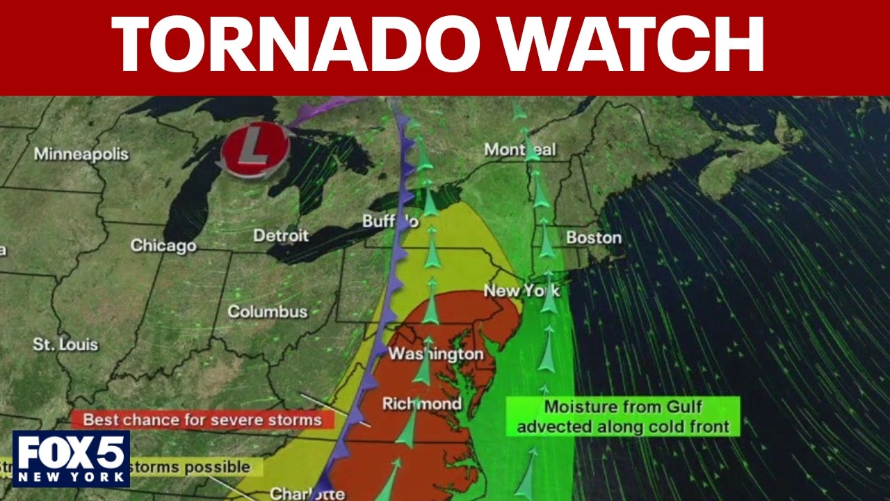
The National Weather Service has issued a tornado watch for parts of New Jersey until 7 p.m. Monday, warning that conditions could support damaging wind gusts and isolated tornadoes as the system moves through the region.

What does a tornado watch mean?
A tornado watch is issued if weather conditions favor thunderstorms capable of producing tornadoes in a region. You should watch for additional alerts and be prepared to seek shelter.
Difference between tornado watch and warning
When a tornado has been sighted on the ground or is indicated by weather radar, a tornado warning is issued. You should seek shelter immediately. Stay up to date with the latest alerts by signing up for AlertDC and following the National Weather Service.
Wind advisory
Local perspective:
A wind advisory is in effect for much of the Tri-State area — including New York City, Long Island, parts of New Jersey and southern Connecticut — from 2 p.m. Monday through 4 a.m. Tuesday. A flood watch remains in effect for southern Connecticut from 5 a.m. Monday through 8 a.m. Tuesday.

Even areas outside the advisory zones could still experience strong wind gusts and heavy rain, according to FOX 5 NY meteorologist Liv Johnson.
"Even if you’re not in an area that’s highlighted or under the advisory, we’re still going to get strong wind gusts for everyone," Johnson said. "And not everyone’s going to see flooding conditions, but if you live in an area with drainage issues, we could see some localized flooding."

The storm system moving into the Northeast is weakening compared to the severe weather seen elsewhere in the country, but it will still bring hazardous conditions to the Tri-State region.
High wind speeds
Wind speeds on Monday morning were around 5 to 15 mph, with gusts of 25 to 35 mph in New York City and on Long Island. Conditions are expected to worsen as the day continues.
Timeline:
Forecasters say the calmest part of the day will be Monday morning before heavier rain spreads across the tri-state area by midday.
Will it rain today? When will it stop?
By the evening commute, stronger wind gusts and heavier downpours are expected, especially in parts of New Jersey.
Behind the system, a cold front will usher in much cooler air. Temperatures are expected to drop about 20 degrees from Monday’s highs heading into Tuesday before gradually rebounding later in the week.

Meanwhile, New York officials are also reminding residents to use caution on warm, rainy nights this spring, when hundreds of amphibians emerge for their annual breeding migration.
As temperatures rise after a winter of Arctic blasts across the Northeast, forest salamanders and frogs begin moving toward breeding areas.
The migration typically occurs in March and early April when the ground starts to thaw and nighttime temperatures climb above 40 degrees during rainfall.
When is spring?
Big picture view:
Astronomical spring begins Friday, March 20, marking the vernal equinox. The equinox occurs when the sun crosses the Earth’s equator, bringing nearly equal amounts of daylight and darkness across the globe.
After the start of spring, daylight hours will continue to increase across the tri-state area as temperatures gradually warm in the weeks ahead.
The Source: This report is based on information from the National Waether Service, FOX Weather and FOX 5 NY's Liv Johnson.