

Snow storm forecast: Timeline, how many inches NY, NJ, CT can expect
NEW YORK - A powerful winter storm quickly dumped snow onto New York City, falling as quickly as 1 to 2 inches per hour.
Despite an early Sunday transition from snow to freezing rain and sleet, a few inches stuck throughout the region. Check here for snow totals and updates.
JUMP TO: LIVE RADAR | STORM TIMELINE | EXPECTED SNOW TOTALS

Current Winter Weather Alerts. (FOX Weather)
A previous version of this forecast report can be found below:
Here's a timeline of when the NYC-area should expect snow, sleet and the highest intensity of snowfall. Plus, check out expected snow totals for your area, track live radar, learn about another winter storm system forecast to bring more snow next week:
Live radar and news
We're streaming live radar and webcams from the storm's path in the YouTube player below. Our interactive radar can be found here.
You can also watch live updates from the FOX Weather team in the media player above.
Winter storm and snow timeline for NYC
Timeline:
Winter weather alerts were issued for the entire area.

5 p.m. Saturday: A Winter Storm Warning took effect for Connecticut, the Lower Hudson Valley and parts of northeast New Jersey. A Winter Weather Advisory took effect for New York City, Long Island and most of New Jersey.
7 p.m. Saturday: Snowfall is expected to intensify throughout the night, with 1 to 2 inches per hour of snowfall possible. Road conditions will be hazardous. Ice accumulation is possible.
10 a.m.: Snow could begin turning into sleet in some areas.
1 a.m. Sunday: Temperatures will begin to rise above freezing. The snow will mix with and/or change to freezing rain and sleet. Coastal areas will likely see a transition to rain as precipitation intensity lessens.
7 a.m. Sunday: The rain and snow mix gradually subsides.
11 a.m. Sunday: The warning and advisory are lifted.
Tuesday evening-Wednesday: The National Weather Service says there is a 30 to 50% chance for more snow accumulation from another storm system

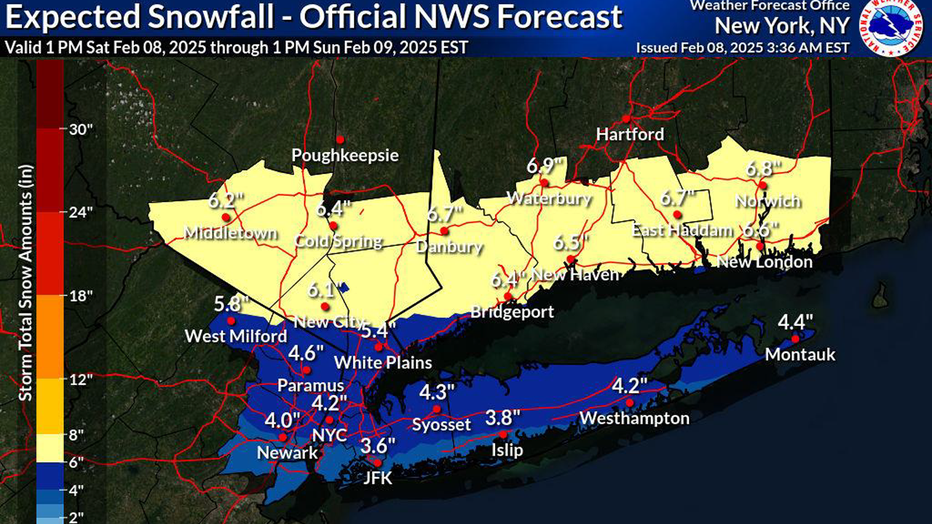
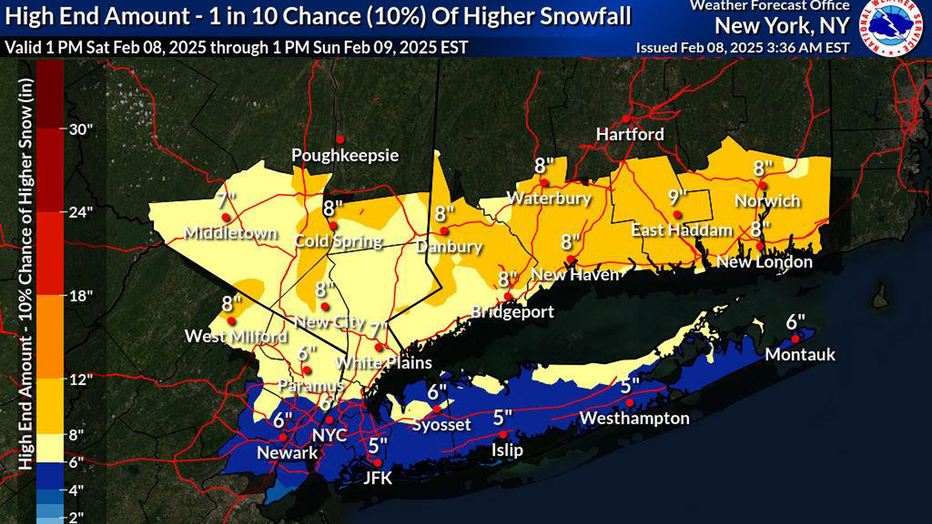
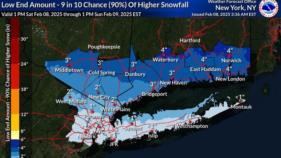
Snow totals: How many inches to expect
According to the National Weather Service, NYC, northern New Jersey and most of Long Island can expect 3 to 5 inches of snow, though northern Suffolk County may see higher totals. Connecticut and the Lower Hudson Valley can expect 5 to 8 inches of total accumulation, and the entire area will see a light glazing of ice.
Dig deeper:
How much snow we'll see depends on whether surface temperatures rise above freezing during the storm.
On the higher end, 5 to 8 inches is possible for most of the region if there is snow banding and the wintry mix is limited.
If the storm trends north or the wintry mix pushes inland quickly, NYC will see little to no accumulation.
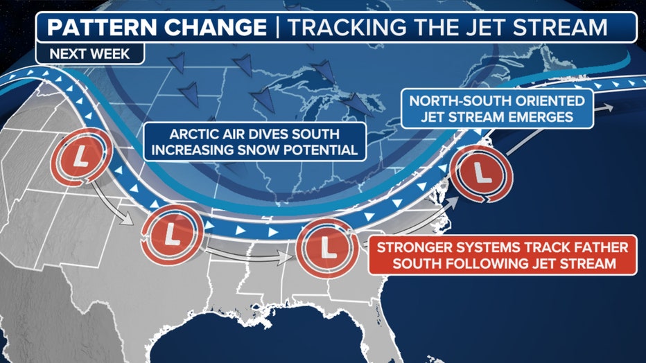
More snow next week
What's next:
Don't get too comfortable – next week has many more chances for snow in New York City as forecast models show a change in the jet stream pattern.
Overall weather pattern for 2/10/2025 (FOX Weather)
According to FOX Weather, New York City is potentially seeing double-digit totals from storm systems that will impact the region from Monday, Feb. 10 to Monday, Feb. 17.

Snowfall forecast( FOX Weather)
Exact snowfall amounts are still being fine-tuned, so uncertainty in the track and precipitation type for each system still remains.
- Tuesday: A 50% chance of snow after 1 p.m. Mostly cloudy, with a high near 35.
- Tuesday night: Snow likely. Cloudy, with a low around 31. The chance of precipitation is 60%.
- Wednesday: A 30% chance of snow. Mostly cloudy, with a high near 37.
- Wednesday night: A 50% chance of snow. Mostly cloudy, with a low around 31.
- Thursday: A chance of rain and snow. Mostly cloudy, with a high near 37. The chance of precipitation is 50%.
The country’s active weather pattern is expected to continue throughout most of the month, with no relief in sight for the nation's heartland through the East Coast.
The Source: This article uses reporting from the National Weather Service and FOX Weather.