

NYC weather forecast: Expect a major warm-up, powerful storm this week
NEW YORK - Check here for the latest NYC weather forecast.

NYC weather: When will it rain in NY, NJ, CT?
NYC's weather forecast shows warm, spring-like temperatures heading our way – but a powerful, fast-moving storm is also expected to bring widespread rain and possible snow for other areas of New York.
NYC's weather forecast shows warm, spring-like temperatures heading our way – but a powerful, fast-moving storm is also expected to bring widespread rain and possible snow for other areas of New York.
JUMP TO: RAIN TIMING l WHERE WILL IT SNOW? l NEXT NYC SNOW CHANCE
The FOX Forecast Center expects plenty of precipitation. However, since it's still a few days away, there is some time to fine-tune the forecast, and some changes can be expected.
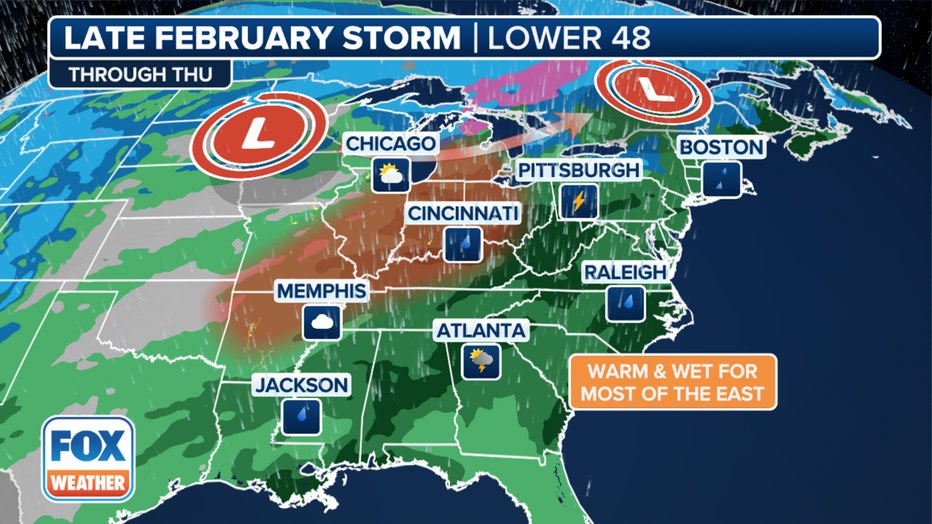
This graphic shows the progression of the cross-country storm through Thursday, Feb. 29, 2024. (FOX Weather)
"That won't be here until sometime late Tuesday into Wednesday and that's that wet weather stretch that we have coming through for you late Tuesday into Wednesday," FOX 5 NY's Mike Woods said.
Meanwhile, highs will reach the low 60s midweek. Will skies clear in time for New Yorkers to enjoy the warmer weather?
Timeline: When will it rain in NYC?
Tuesday: A 50% chance of showers after 4 p.m. Partly sunny, with a high near 56.
Tuesday night: Showers, mainly after 7 p.m. Low around 52. Breezy. Chance of precipitation: 90%.
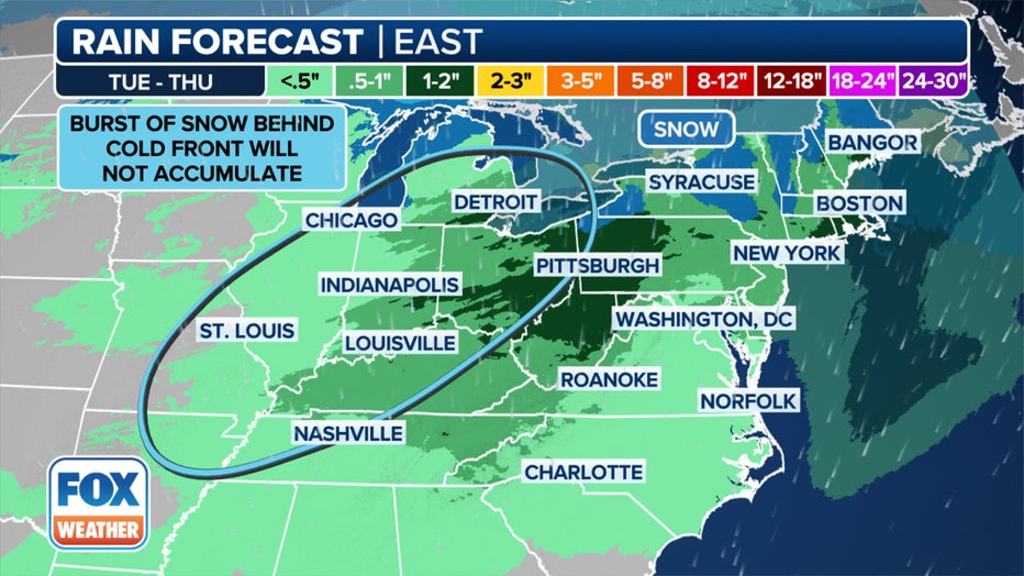
This graphic shows forecast rain totals in the East. (FOX Weather)
Wednesday: Showers. High near 60. Breezy. Chance of precipitation: 90%.
Wednesday night: Showers, mainly before 1 a.m. Low around 33. Wind chill values between 20 and 25. Breezy. Winds could gust as high as 39 mph. Chance of precipitation: 80%.
Impacts: Where will it snow Wednesday?
Lower rainfall totals are expected in the Northeast.
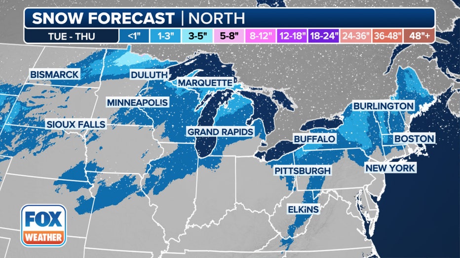
This graphic shows forecast snow totals in the northern tier.(FOX Weather)
But temperatures may be cold enough to allow for snow to break out, especially in the higher elevations in upstate New York.
When will it snow again?
Arctic outbreaks look highly unlikely as we wrap up meteorological winter at the end of the month, the FOX Forecast Center said.
The U.S. is experiencing a strong El Niño, meaning the Tri-State is more likely to see warmer-than-average temperatures and wetter-than-average precipitation.
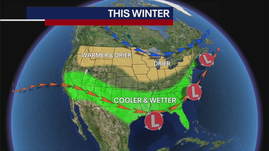
As we move forward, strong El Niño conditions will continue, meaning February will feature the same type of weather we've seen: above-average temperatures and borderline rain-snow events.
The first day of spring 2024 is Tuesday, March 19.