

NYC winter weather outlook 2026-2027: Snow total predictions, 'Super El Niño' forecast
NYC winter weather outlook 26-27: Snow total predictions, forecast
FOX 5 NY's chief meteorologist Nick Gregory shares his 2026-2027 outlook for the winter season, including snow total predictions and a forecast for the "Super El Niño."
NEW YORK CITY - As a beautiful fall winds down, FOX 5 NY's Nick Gregory is sharing his 2026-2027 winter outlook, which is shaping up to be a lot milder than last season, when nearly 60 inches of snow fell in New York City.
JUMP TO: FIRST DAY OF WINTER l ‘SUPER EL NIÑO’ l SNOW TOTAL PREDICTIONS
Winter forecasts this year come down to four key indicators:
- A "super El Niño" bringing above-average temperatures from the south
- A weakened polar vortex unleashing colder air from Canada
- An uncertain North Atlantic Oscillation
- Above-average Siberian snow cover
First day of winter 2026
Timeline:
Winter officially begins in the Northern Hemisphere on Dec. 21 with the winter solstice – the day with the least amount of possible daylight and the longest night.
‘Super El Niño’ winter weather forecast
Big picture view:
El Niño refers to warmer-than-average sea surface temperatures along the equatorial latitude in the Pacific Ocean.
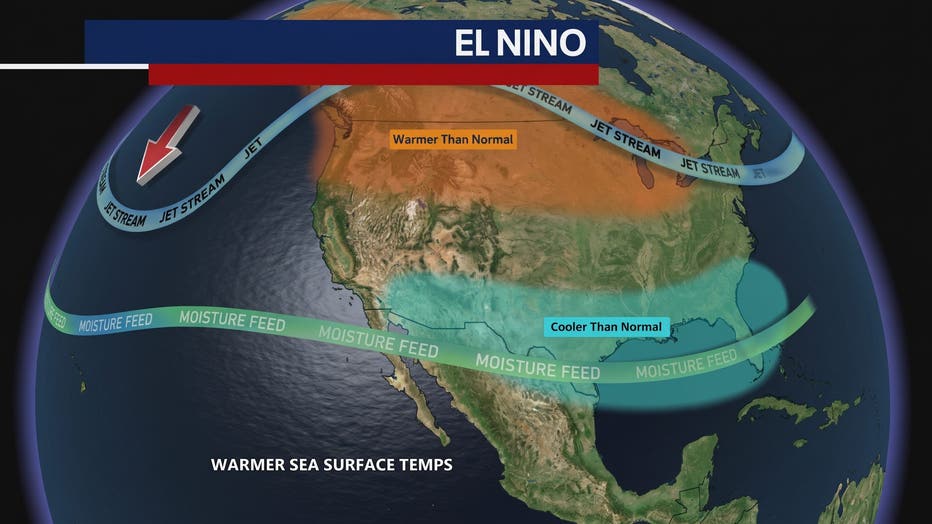
It causes an intensified southern jet stream that forces the polar jet stream to retreat further into southern Canada. The results are milder, dry conditions in the northern U.S. and a cool, wetter-than-normal forecast for the southern part of the country.
This year, we're experiencing a "Super El Niño," with water temperatures rising to a historic 4.77°F above average, outpacing each of the four previous "Super El Niño" years of 2015, 1997, 1982 and 1877.
Strong El Niño winters
A strong El Niño winter doesn't automatically mean there won't be snow. It tends to bring more coastal storms along the Eastern Seaboard, but the above-average temperatures mean rain is more likely.
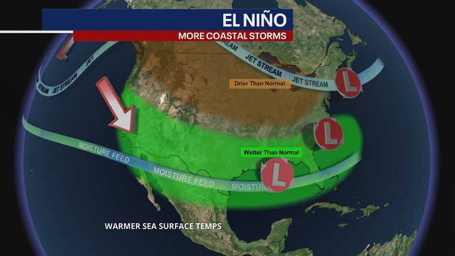
El Niño can still cause a variety of outcomes. In 2015-2016, the region saw a total of 31.2" of snow, but 27.5" came from one blockbuster storm in January 2016.
Here are the other previous totals:
- 1997-98: 5.5" of snow
- 1982-83: 27.2" of snow
- 1877-78: 8.1" of snow
What is the polar vortex?
Gregory describes the polar vortex as a high-speed "racetrack wind pattern" that circles the North Pole when stable. If it becomes fractured or weakened, arctic air can spill down into the eastern U.S.
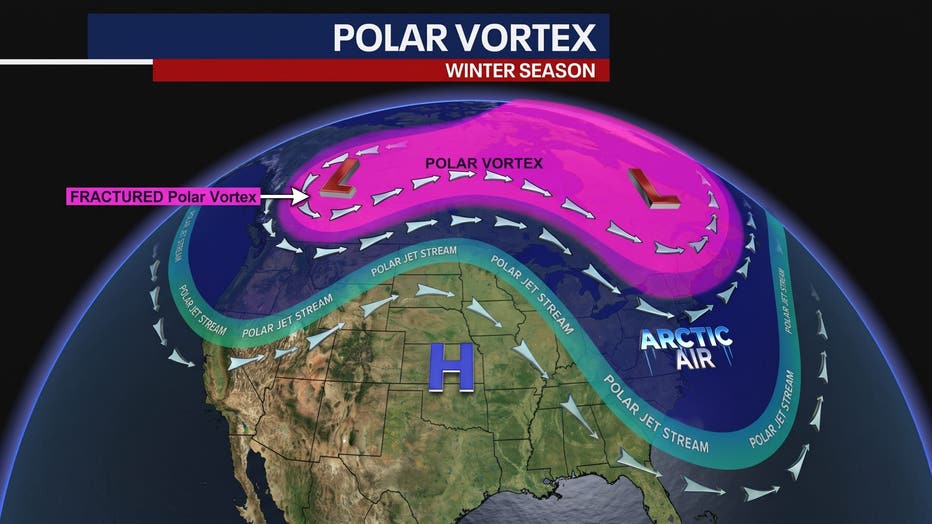
The polar vortex weakened in early November this year, which has never happened for as long as forecasters have been tracking it. This is worth keeping an eye on.
North Atlantic Oscillation
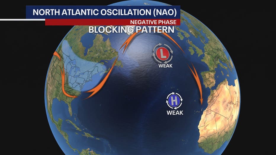
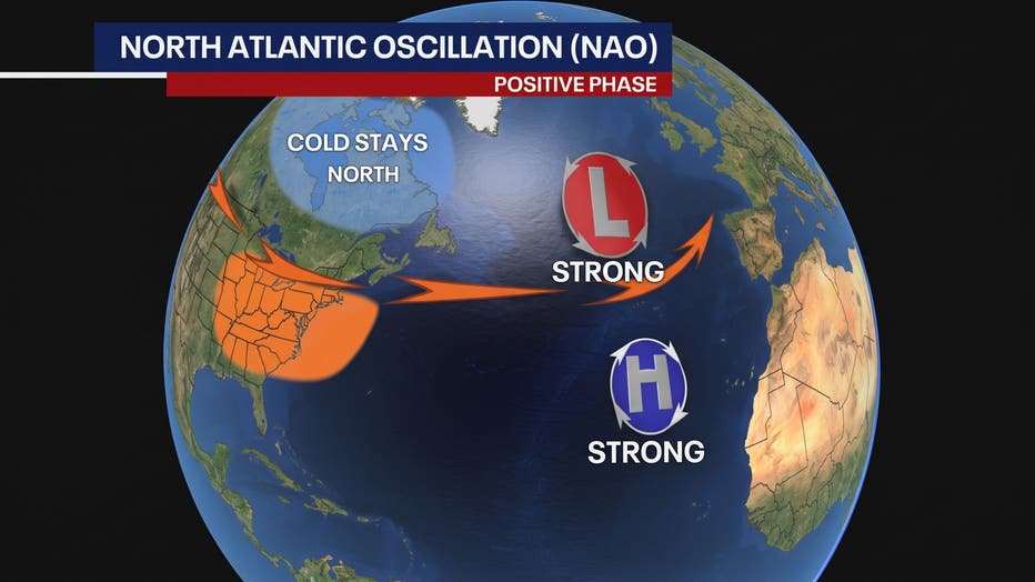
The North Atlantic Oscillation (NAO) is a pressure oscillation that stretches from the North Atlantic down to the subtropical Atlantic.
When in its negative phase, the NAO forms a blocking pattern around Greenland that forces cold air down from Canada, resulting in coastal storms. In the past, this has caused some major snowstorms in the New York City area.
In its positive phase, the NAO sees much stronger pressure variation in the Atlantic, resulting in a stronger westerly wind. Cold air stays north, keeping temperatures mild around here.
Siberian snow cover
Arctic, or Siberian, snow cover started early this year. In fact, it's already above average. What does that mean? Colder air can more easily travel across the North Pole, disrupt the polar vortex and send more cold air into the eastern U.S.
Will there be a blizzard this winter?
Gregory predicts there will be multiple coastal storms this winter, but with a lower-than-average amount of snow. Since the super El Niño leads to milder temperatures, the storms can vary between snow, ice and rain along the coast.
You'll probably have to be well inland to get a good amount of snow this year.
How much snow will fall in the NYC area?
By the numbers:
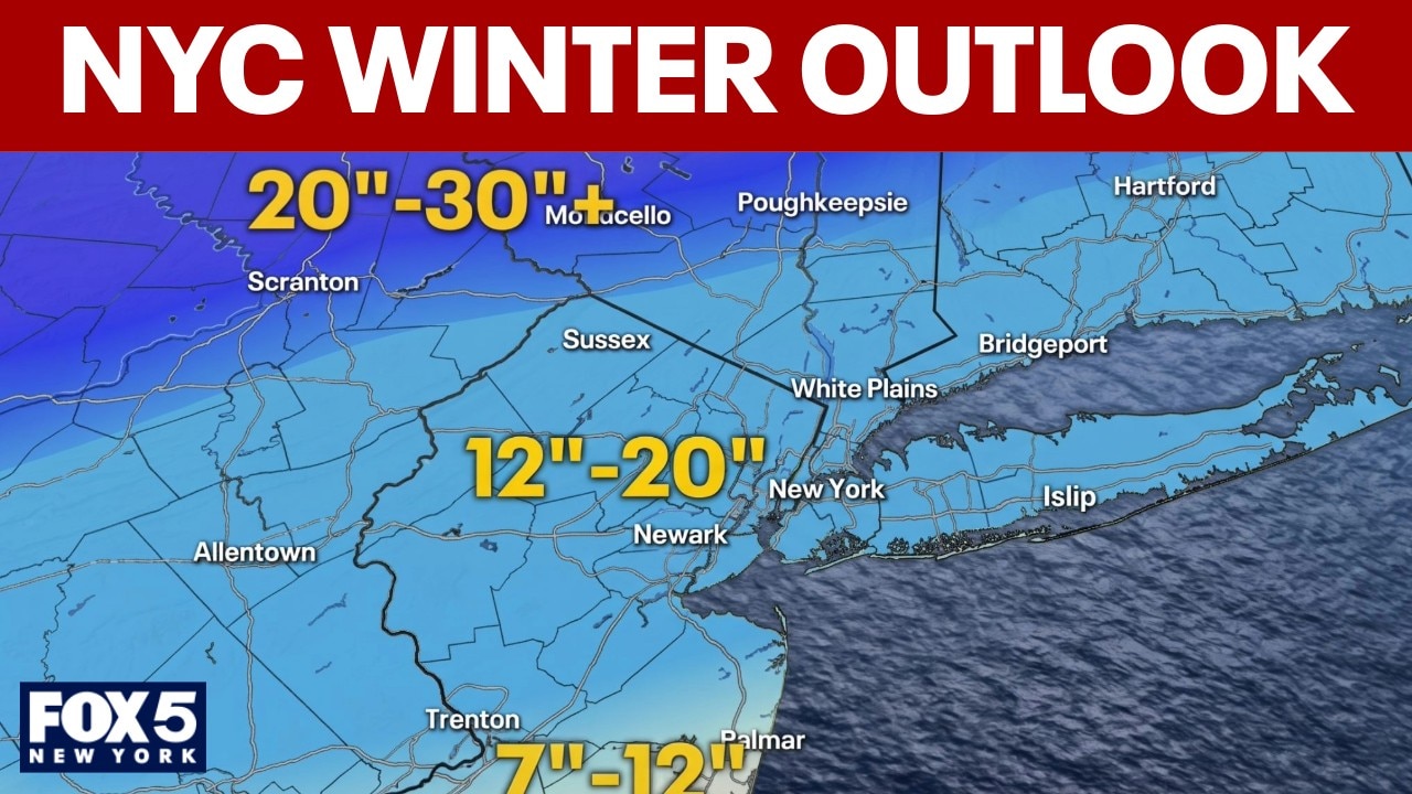
Gregory predicts New York City and the nearby suburbs could see 12-20" of snow this year, but he notes that might be too generous, all things considered.
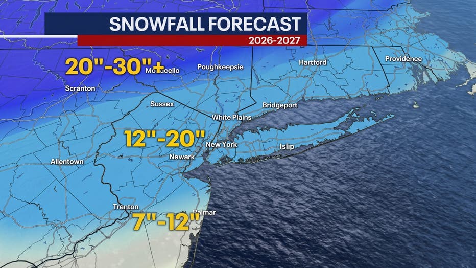
New Jersey, the Mid and Lower Hudson Valley, and Connecticut are along the same line. Areas of New Jersey that are further south of the city could get 7-12" of snow. The Upper Hudson Valley and Catskills could see significantly more snowfall, with totals ranging between 20 and 30 inches.
Regional, national winter outlooks
NOAA
NOAA uses a mix of long-range climate computer models and atmospheric trends, such as the arrival of El Niño, to base its long-range outlooks. With that, NOAA forecasts above-average temperatures for the northern U.S. and above-average precipitation for the southern states and up the East Coast – typical for an El Niño winter.
The Source: This article was written with information from the National Weather Service and reporting by FOX 5 NY meteorologist Nick Gregory.