

NYC weather forecast: Models show growing threat of weekend snowstorm; winter storm watch issued
NEW YORK - A winter storm watch has been issued for parts of the New York City area for this weekend, as the threat of a snowstorm is on the table.
SUNDAY STORM FORECAST: TIMELINE | MODELS BREAKDOWN | NOR'EASTER SCENARIOS
Forecasters are tracking a developing coastal storm that could bring accumulating snow to parts of the Tri-State area Sunday night into Monday morning.
Snow accumulation for Sunday

Northeast chances for 6 inches of snow. (FOX Weather)
However, a number of factors must line up to produce blockbuster impacts, namely a slow and precise track along the northeast coast and enough cold air from Canada. Snow totals will be limited if any one of these forecast ingredients is missing.
Will it snow on Sunday? Winter storm watch NYC
Timeline:
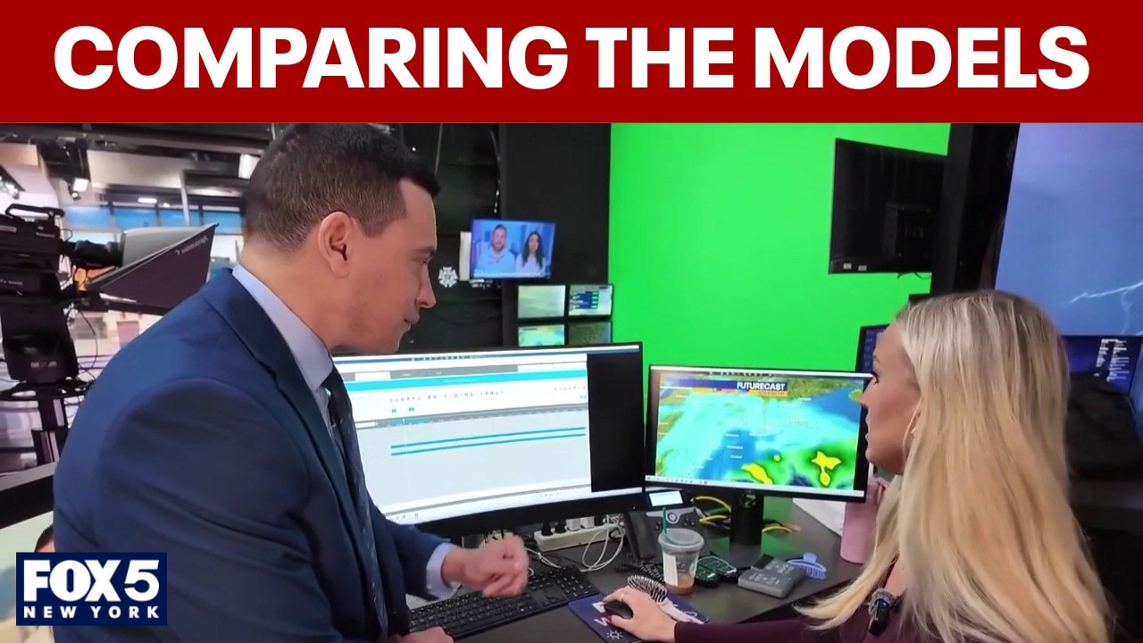
FOX 5 NY Meteorologist Liv Johnson said the timeline for snow appears increasingly likely Sunday night into early Monday, but exact totals remain uncertain and depend on the storm’s track.
Weekend update: Snow timeline, impacts for NYC
FOX 5 NY's Liv Johnson has the latest on potential snow for the New York City area this weekend.
"We do expect snowfall," Johnson said, noting that even small shifts in the path of the low-pressure system could mean the difference between a light dusting and several inches requiring shoveling.
New York winter storm: GFS vs NAM model
Dig deeper:
Johnson compared several forecast models:

Photo credit: The National Weather Service.
- The GFS model shows a more aggressive scenario, suggesting a longer-lasting storm with the potential for 5 to 10 inches of snow in parts of the region.
- The NAM (North American Model) also brings snow Sunday night into Monday, but keeps the heaviest bands more limited, with less impact north into the Hudson Valley and parts of northern New Jersey.
- Other guidance, including the Baron model, keeps the storm farther offshore, which would significantly reduce snowfall totals in the New York City area.
Most models currently suggest the highest snowfall totals may fall across southern and central New Jersey, including areas along the Jersey Shore, with more variability farther north.

Winter Weather Alerts issued for Nor'easter. (FOX Weather)
Regardless of final totals, Johnson said the Monday morning commute is likely to be messy if snow develops as expected. Saturday, however, is forecast to remain dry and relatively mild before colder, windier conditions arrive Sunday.
Nor'easter threat: Scenarios
Big picture view:
FOX Weather reports that the threat of a significant storm is increasing across the Northeast, including New York City area.

Potential weekend storm scenario. (FOX Weather)
According to the FOX Forecast Center, the storm is expected to move offshore Sunday and strengthen into a powerful coastal system. However, several factors must align for a high-impact snowstorm, including a precise track along the Northeast coast and sufficient cold air in place.
"Even a 50-100 mile jog east or west with the storm will result in less or more snow for millions," the FOX Forecast Center said Friday.

Potential weekend storm setup. (FOX Weather)
Snow totals would be limited if any of those ingredients fail to come together. Forecasters say the outlook should become clearer later Friday and into Saturday as newer model data comes in.
For now, New Yorkers should prepare for the possibility of accumulating snow late Sunday into early Monday — and monitor updated forecasts as the storm’s track becomes better defined.
Weather in NYC today
- Friday: On Friday, periods of rain are expected with temperatures holding steady around 39 degrees. The chance of precipitation is 100%, and rainfall totals between a quarter- and half-inch are possible. Friday night brings a 30% chance of rain before 1 a.m. Skies will remain mostly cloudy with temperatures around 42 degrees as winds shift from north to west.
- Saturday: On Saturday, there is a 20% chance of rain after 1 p.m., otherwise partly sunny skies are expected with a high near 46 degrees. Saturday night, rain is possible before 10 p.m., then precipitation could change to snow as colder air moves in. The low will be around 35 degrees with a 30% chance of precipitation.

Updated snow potential for the Northeast. (FOX Weather)
- Sunday: On Sunday, there is a 50% chance of snow under cloudy skies with a high near 38 degrees. Sunday night, the chance of snow remains at 50% with cloudy conditions and a low around 32 degrees.
About the two models
In the U.S., the two most popular models you'll see mentioned on social media are the Global Forecast System (GFS), also colloquially known as "The American Model", and the model run by the ECMWF, the European Centre for Medium-range Weather Forecasts, colloquially known as "The European" model, or "Euro" for short.
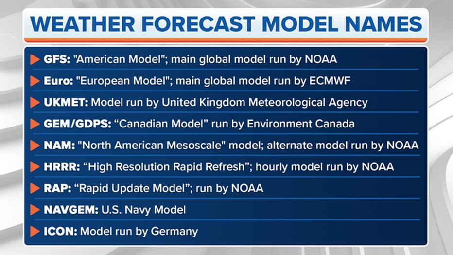
Photo credit: FOX Weather
NOAA runs the GFS with support from several other U.S. research and government entities. The ECMWF is based in England but is a private consortium supported by 34 European countries.
There are different models run by government weather agencies, but the Euro and GFS are the two you'll hear about most often.
NYC weather radar
Click HERE for more information.
Stay ahead of the snow with FOX 5’s expert meteorologists, streaming LIVE on FOX LOCAL. We’re streaming nonstop coverage with the newest forecasts, snow potential, and preparation tips—before the storm and all weekend long. Download FOX LOCAL for 24/7 weather coverage on your smart TV and mobile devices.
The Source: This report is based on information from the National Weather Service, FOX Weather and FOX 5 NY's Liv Johnson.