

Severe thunderstorms in NYC area, flooding possible, heat advisory continues
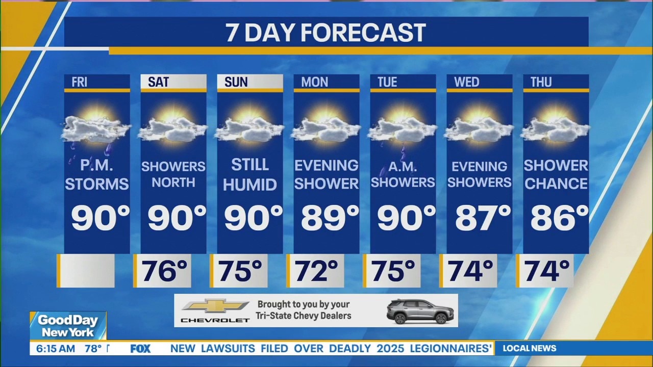
NEW YORK - New York City and the surrounding area are under a severe thunderstorm warning with storms Friday evening.
Severe thunderstorm, flash flood warnings
What we know:
Severe thunderstorm warnings were issued for Manhattan, Brooklyn and Queens Friday evening until 6:30 p.m.
Another warning has been issued for parts of Bergen and Passaic counties in New Jersey and Rockland County, New York until 8:45 p.m.
New York City and the surrounding area are also under a Flash Flood Warning until 9 p.m.
Scattered showers and thunderstorms could lead to damaging wind gusts and flash flooding, the NWS said.
NJ Transit Friday night had to suspend multiple rail likes because of "weather-related issues" near Newark. The agency shared a photo of a fallen tree over tracks near Newark on Social media.
The Morris, Essex and Gladstone Branch line was closed in both directions between Summit and Newark's Broad Street station. The Montclair Boonton line had service suspended in both directions between Hoboken and Hackettstown.
Timeline:
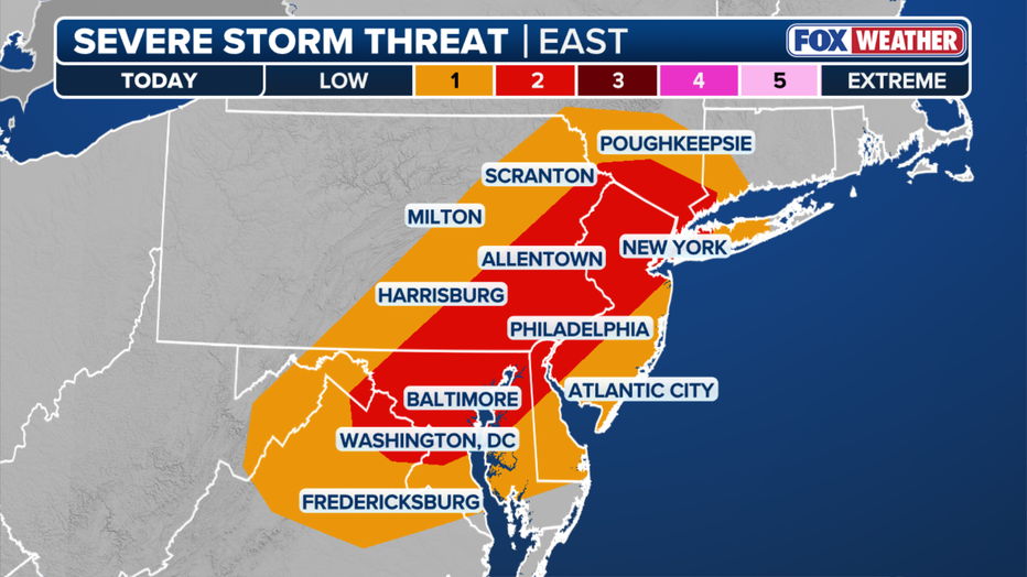
Storms will likely begin forming in the Tri-State Area after 2 p.m., with the greatest chance from 4 p.m. on.
FOX 5 NY meteorologist Mike Woods said there was a 50-60% chance of storms in the Tri-State Area beginning Friday afternoon.
The area is under a "Level 2 risk" for strong-to-severe storms, which means larger areas could be impacted, Woods said.
Dig deeper:
Friday's storm risk comes in the middle of a long hot and humid stretch for the New York City area, including Long Island, New Jersey and Connecticut.
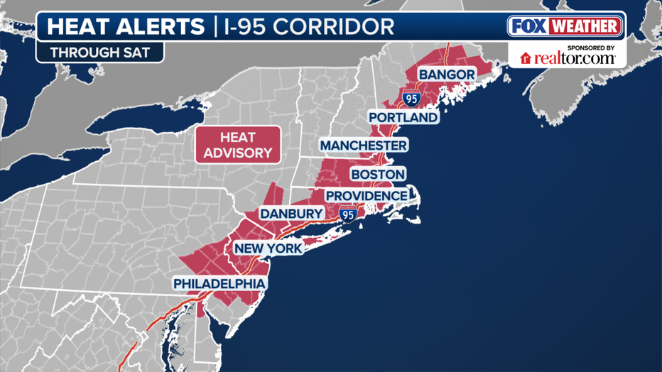
The entire region is under a heat advisory until 8 p.m., with the heat index approaching 95 in the city.
An air quality alert is also in effect until 11 p.m. with concern about high levels of ozone build up.
Central Park registered a moderate Air Quality Index of 55 at noon, but AQI could reach unhealthy levels later in the day because of the heat and humidity.
The Source: This includes forecasting from the FOX 5 NY weather team.