

NY, NJ Weather: Severe storm threat Friday, forecast for strong wind gusts, isolated tornado risk
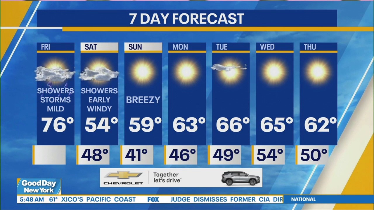
NEW YORK - Severe weather is heading toward the Tri-State Area on Friday, bringing a line of thunderstorms, potentially damaging winds and even the chance for an isolated tornado.
Live Weather Coverage
NYC thunderstorms, tornado risk
Timeline:
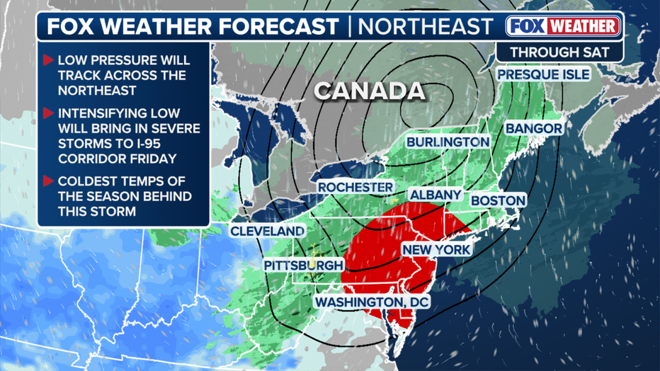
A major cold front is setting the stage for severe weather across the northeast, including northern New Jersey and the entire New York City area, on Friday.
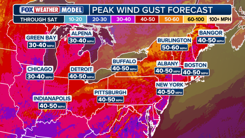
Severe weather is expected to develop this afternoon, with the main threat being wind gusts around 50-60 mph in northern New Jersey and NYC as thunderstorms roll through the region.
FOX Weather
The heaviest rain and highest chances for severe storms are expected around the evening commute, between 6 p.m. and 9 p.m. An isolated tornado risk cannot be ruled out for this period.
FOX Weather
Residual rain showers may linger into early Saturday, particularly across coastal communities, before cooler air sinks into the region and brighter skies take over for the weekend.
Severe storm threat level
Local perspective:
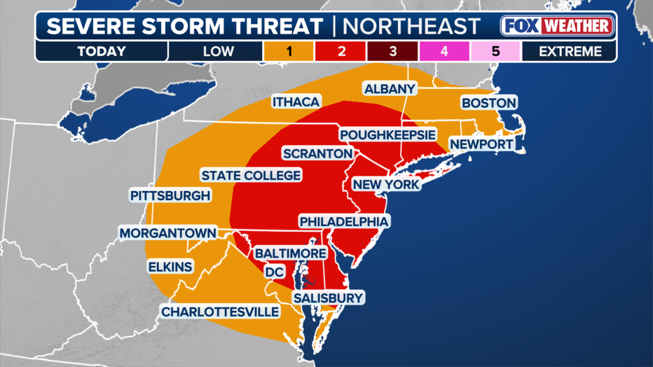
NOAA issued a Level 2 out of 5 risk of severe thunderstorms for New Jersey, the New York City metro area, Long Island, the Lower Hudson Valley and southwestern Connecticut on Friday.
FOX Weather
Forecast models project around 0.5 inches of rain for most of the Tri-State Area by Saturday morning.
Next storm system
What's next:
Forecasters are monitoring another system developing in the southeastern states that could potentially bring more rain by Monday, but the models remain split, for now.
The Source: This article is written with information from FOX Weather, the National Weather Service and FOX 5 NY meteorologist Mike Woods.