

Snow Saturday: 6+ inches blanket parts of NYC, NJ, Long Island

Winter storm slams Northeast
Nearly 10 inches of snow accumulation were reported in Brooklyn after a fast-moving winter storm swept over the Northeast overnight Saturday.
NEW YORK CITY - People across the NYC area woke up to fresh snow on Saturday morning, seeing more than 6 inches of accumulation in parts of NYC, NJ and Long Island thanks to a fast-moving winter storm.
JUMP TO: SNOW TOTALS l WINTER FORECAST
Snowfall in Central Park totaled 2 inches, while JFK Airport recorded over 6 inches.
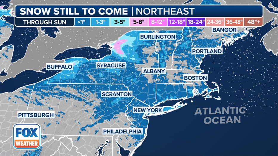
More snow is still to come in the Northeast through Sunday. (FOX Weather)
Snow showers are likely during both Saturday and Sunday afternoons.
The FOX Forecast Center said heavy snow bands caused snow rates to exceed 1 inch per hour in the region. The highest accumulations were seen where a narrow band of intense snowfall dumped around a foot of snow across portions of New Jersey.
The region will be on a gradual warming trend starting Monday through the week before the next chance of wintry weather next weekend.
Snow totals: How much snow has fallen so far?
NYC
- Central Park (Manhattan): 2.0 in
- JFK Airport (Queens): 6.1 in.
- La Guardia Airport (Queens):2.7 in.
- New Dorp (Staten Island) 8.6 in.
- Tottenville (Staten Island): 7.8 in.
- Coney Island (Brooklyn) 9.9 in.
- Bay Ridge (Brooklyn): 7.6 in.
NJ
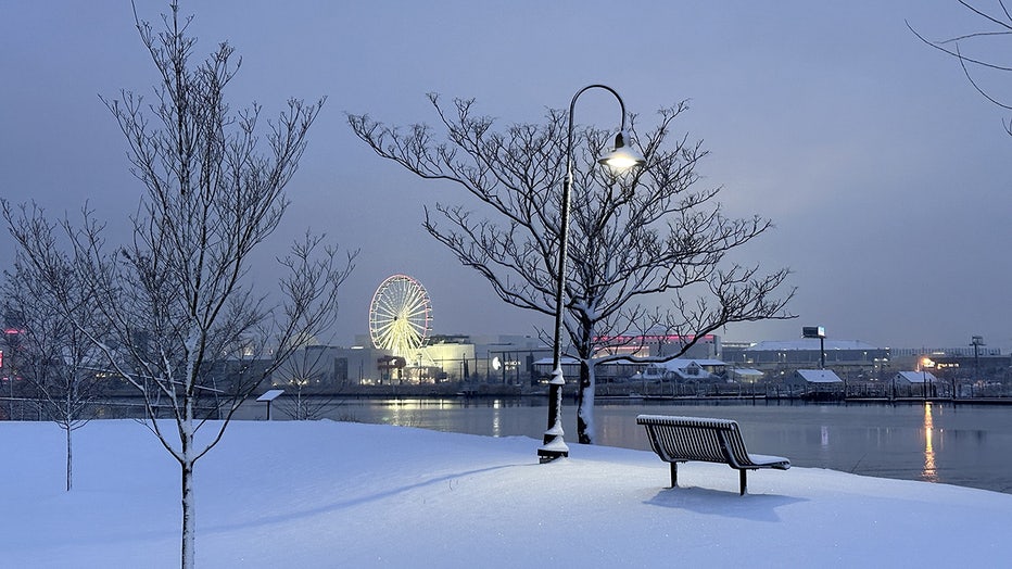
A view of the park covered in snow during winter at Hudson County, Secaucus, New Jersey on February 17, 2024. (Photo by Islam Dogru/Anadolu via Getty Images)
- Carteret: 8.8 in.
- Edison: 9.0 in.
- Metuchen: 10.9 in.
- Middlesex: 8.0 in.
- Old Bridge: 9.0 in.
- Sayreville: 6.0 in.
CT
- Danbury: 3.1 in.
- Fairfield: 2.0 in.
- Greenwich: 2.3 in.
- Monroe: 2.5 in.
- Norwalk: 2.5 in.
Click HERE for a full list of snow totals in our area.
Mid-winter weather outlook: ‘6 more weeks’ of winter
FOX 5 NY’s Nick Gregory said the NYC area has the potential for several more inches of snow, according to his mid-winter forecast.
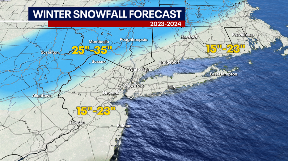
Map shows the snowfall total forecast for NYC, NY, NJ and CT for winter 2023-24. (FOX 5 NY)
Only one or two decent storms will help us reach the projected total, and Nick forecasts that February will provide the perfect conditions for winter storm development.
The U.S. is experiencing a strong El Niño, meaning the Tri-State is more likely to see warmer-than-average temperatures and wetter-than-average precipitation.
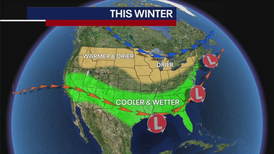
As we move forward, strong El Niño conditions will continue, meaning February will feature the same type of weather we've seen: above-average temperatures and borderline rain-snow events.
"I think winter will be prolonged here, and I do think that we'll probably have a good surge of cold weather coming in the middle part of February, [creating the potential for a snow storm or two," Nick said.
FOX Weather's Chris Oberholtz and Andrew Wulfeck helped contribute to this report.