

NYC winter storm: Ice, snow, sleet could create 'hazardous' travel later this week

NEW YORK CITY - A developing winter storm is expected to bring a mix of freezing rain, snow, sleet and ice to New York City, making for a potential slippery and slick Thursday morning commute.
WEATHER FOR THE WEEK: SNOW TIMELINE l LOCAL IMPACTS l WEEKEND STORM
Ice storm this week: Timeline
Timeline:
Computer forecast models are coming into agreement that the storm will develop across the Plains on Wednesday before gaining strength as it sweeps east across the U.S.
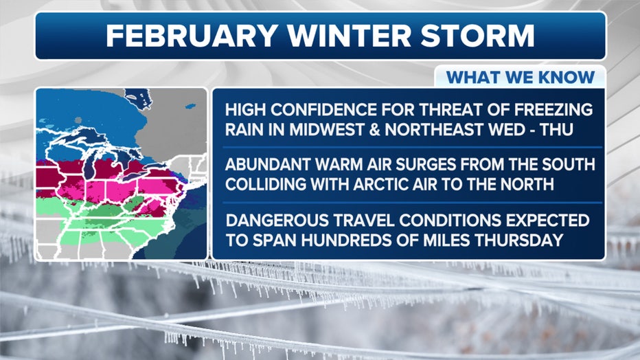
Here's what we know about the incoming winter storm. (FOX Weather)
As the system moves off to the east, a strong southerly jet stream will kick in, pulling in warm, moisture-rich air across the eastern half of the nation. That setup will then lead to the development of a warm front, separating subfreezing air to the north from record-breaking warmth to the south.
- Wednesday night: Snow likely, mainly after 4 a.m. Mostly cloudy, with a steady temperature around 33. The chance of precipitation is 60%.
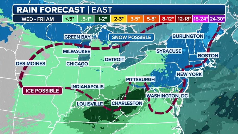
This graphic shws the rain forecast in the Northeast and New England. (FOX Weather)
- Thursday: Snow and sleet before 9 a.m., then rain, snow, and sleet between 9 a.m. and 11 a.m., then rain after 11 a.m. High near 41. The chance of precipitation is 100%.
Local perspective:
The issue is that the warm air will move in above a shallow layer of subfreezing air near the ground. The FOX Forecast Center said that will lead to a large swath of impactful freezing rain that will fall across the region.
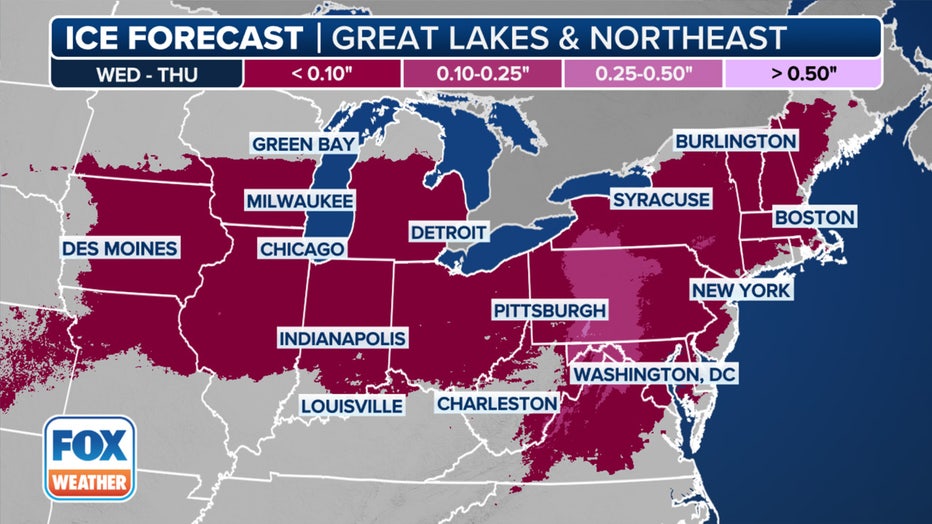
This graphic shows the ice forecast. (FOX Weather)
According to the FOX Forecast Center, from the NYC area northward, the cold air will be deep enough that snow will be a concern during the onset of the winter weather. Cities like the Big Apple could see snow fall during the middle of the Thursday morning commute.
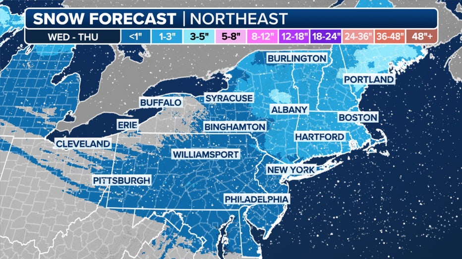
This graphic shows the forecast snow totals in the Northeast and New England. (FOX Weather)
That could wreak havoc on the roads, but the FOX Forecast Center said warm air will move in, changing the snow to either freezing rain or plain rain. Any snow left behind will nearly completely melt.
How much snow are we getting on Thursday?
By the numbers:
FOX 5 NY's Mike Woods predicts around 1-3" inches of snow for most of the NYC area, North Jersey and all of Connecticut.
NJ snow forecast
Eastern portions of Long Island, as well as central and South Jersey, will mostly likely see between a coating and 1" of snow.
Snow this week
What they're saying:
"Precipitation entering an area spanning from the Midwest to the northern Mid-Atlantic is anticipated to mostly fall as a mix of freezing rain and sleet beginning on Wednesday and lingering through Thursday," the NOAA NWS Weather Prediction Center said in a post on Facebook.
What we don't know:
"Forecast remains highly uncertain in regards to exact precipitation types and expected amounts," NWS Mount Holly said in a post on X. "Expected impacts may change with coming updates."
Weekend storm?
What's next:
The system will quickly exit by Thursday, leaving mainly dry conditions in its wake on Thursday night and Friday. However, another winter storm could impact many of these same areas over the weekend.
- Saturday: A 30% chance of snow after noon.
- Saturday night: Snow and sleet before 10 p.m., then rain and sleet between 10 p.m. and 3 a.m., then rain after 3 a.m. The chance of precipitation is 90%.
- Sunday: Rain likely. The chance of precipitation is 60%.
FOX Weather LIVE updates
NYC weather radar
Click HERE for more information.