

Tropical Storm Isaias projected path: Tracker, spaghetti models and more
NEW YORK - Tropical Storm Isaias has formed in the southern Gulf and is forecast to rapidly intensify into a Category 2 hurricane and charge toward the northern Gulf Coast later this week.
JUMP TO: LOCATION l PROJECTED PATH l SPAGHETTI MODELS l LOCAL IMPACTS
Florida Gov. Ron DeSantis has already declared a state of emergency ahead of the storm. Meanwhile, the New York City area could see remnants this weekend.
Where is Tropical Storm Isaias?
What we know:
Tropical Storm Isaias is 285 miles from Progreso, Mexico, and 580 miles from the mouth of the Mississippi River. It has sustained winds of 40 mph and is moving east-northeast at 8 mph, according to the NHC's 5 a.m. update.
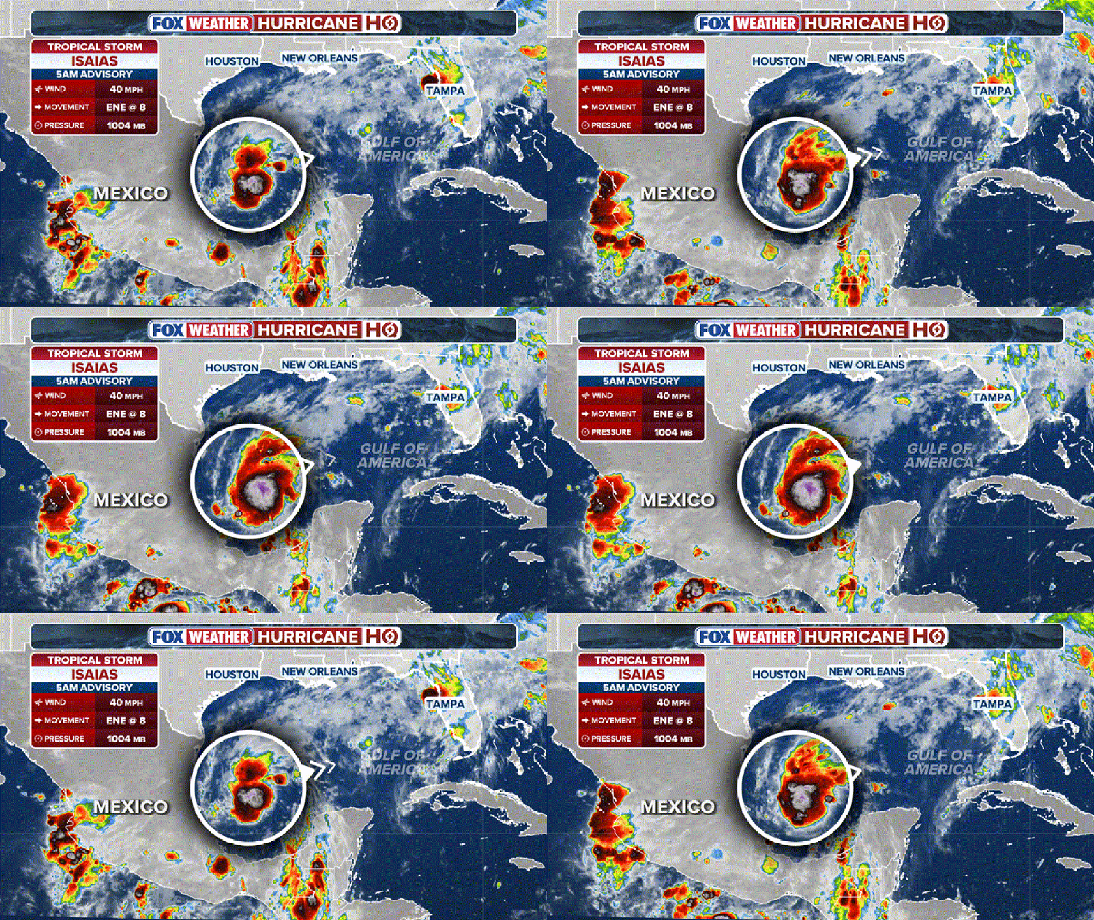
Isaias stats. (FOX Weather)
According to the FOX Forecast Center, Isaias is expected to rapidly intensify between Wednesday morning and 2 a.m. Thursday. Additionally, winds are expected to ramp up and reach 110 mph between 2 a.m. Thursday and 2 a.m. Friday.
Tropical Storm Isaias projected path
Timeline:
Isaias is forecast to remain in the southern Gulf for much of the day on Thursday, bringing heavy rain to the Yucatán Peninsula, before making a sharp turn toward the northern Gulf Coast as it's grabbed by a strong dip in the jet stream.
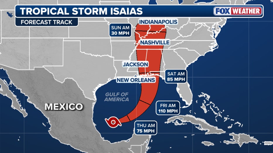
Tracking Isaias. (FOX Weather)
Isaias' forecast cone shows it heading directly toward the northern Gulf Coast, with impacts centered over roughly 30 million people in Louisiana, Alabama, Mississippi and the Florida Panhandle.
Isaias is expected to approach the coast by Friday, with landfall currently estimated to be sometime late Friday or early Saturday between Biloxi, Mississippi, and Panama City, Florida.
Tropical Storm Isaias track, spaghetti models
Big picture view:
Meanwhile, NOAA's Weather Prediction Center (WPC) has issued a flash flood risk for Friday across portions of Louisiana, Mississippi, Alabama, Florida, Georgia, as well as southern portions of Tennessee, southwestern North Carolina and western South Carolina.
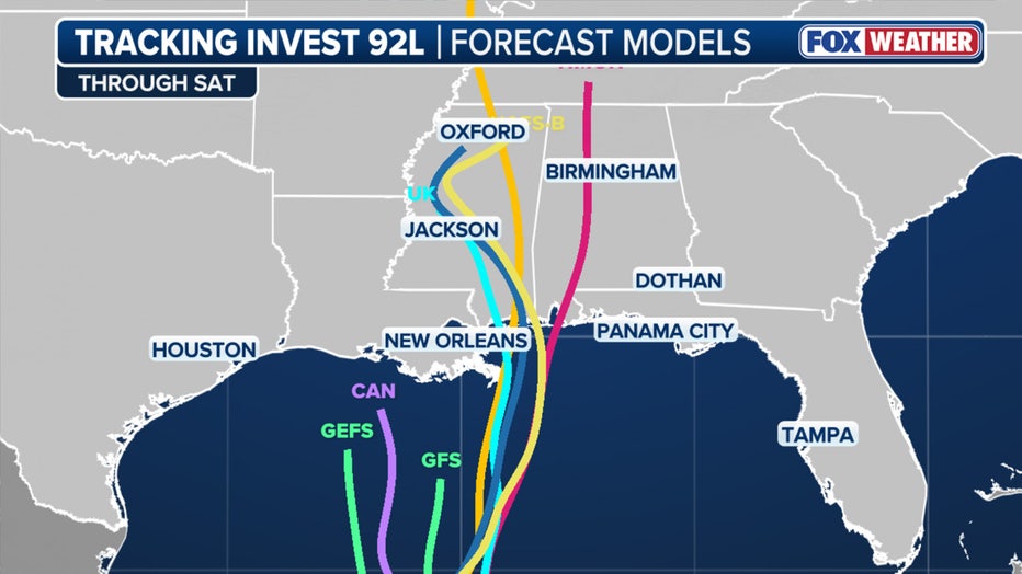
Future Hurricane Isaias Spaghetti. (FOX Weather)
A Level 3 out of 4 flash flood risk covers Mobile, Alabama, and the Florida Panhandle west of Panama City. A Level 2 risk includes Atlanta and Montgomery, Alabama, and eventually shifts inland into Saturday to include the Carolinas and Tennessee Valley.
NOAA's Storm Prediction Center (SPC) has issued a Level 2 out of 5 risk of severe weather for Saturday across southern Alabama and into the Florida Panhandle, with a particular threat of tornadoes as the storm's outer bands come ashore.
Will the Tri-State area see any remnants?
Local perspective:
Meanwhile, the New York City area could see remnants of Isaias from Sunday night into Monday.
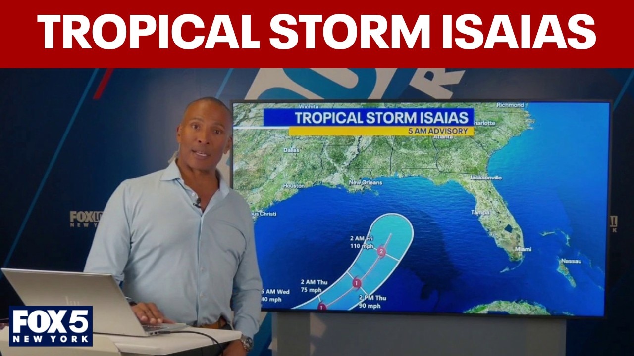
Tropical Storm Isaias track: Will the NYC area see any weekend remnants?
Tropical Storm Isaias has formed in the southern Gulf and is forecast to rapidly intensify into a Category 2 hurricane and charge toward the northern Gulf Coast later this week. Meanwhile, the NYC area, including parts of NJ, could see remnants this weekend. FOX 5 NY's Mike Woods joins Newsroom Live with Dan Bowens with the latest forecast.
"It's more like tropically-fed showers, so it's more like regular showers coming in that have a lot of tropical moisture, and sometimes they have the potential to give us some pretty heavy downpours," FOX 5 NY's Mike Woods said.
Woods said some flooding is even possible.
What we don't know:
Some forecast models show Isaias weakening at landfall, while others show the storm strengthening as strong winds high in the atmosphere interact with it from the north.
The backstory:
September ended without a hurricane for the first time in 32 years, despite it being the climatological peak of the season. The Atlantic hurricane season runs from June 1 to November 30.
The Source: This story was written based on information from FOX Weather, the National Hurricane Center, the FOX 35 Orlando digital team and FOX 5 NY's Mike Woods.