

NYC, NJ weather: Forecast timeline, what to expect as fall nor'easter develops
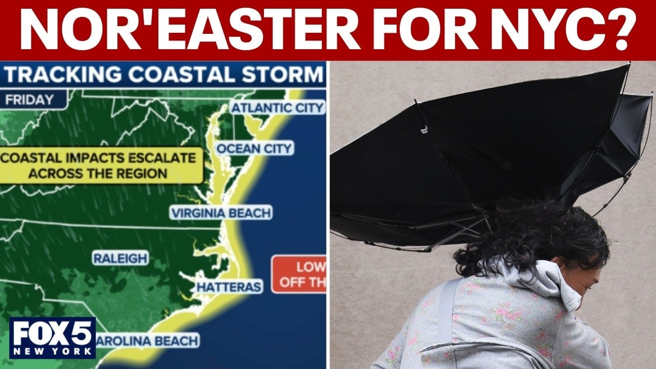
NEW YORK CITY - The first fall nor'easter of 2026 is heading toward the New York City area, potentially becoming a major storm bringing gusty winds, rain and coastal flooding this weekend.
JUMP TO: NOR'EASTER DEFINITION l TIMELINE l IMPACTS l SCENARIOS
Rather than a quick-hitting storm, the system will bring an extended stretch of severe beach erosion, rough surf and the risk of coastal flooding days before the nor’easter heads north.
What is a nor'easter?
The backstory:
Despite popular belief, snow is not a requirement for a nor'easter.
A storm earns the title of "nor'easter" based on wind direction. If a strong low-pressure system off the Atlantic Ocean brings winds that blow from the northeast onto the coast, it's a nor'easter. If those winds are coming out of the east or southeast, it technically misses the definition—even if the impacts on land feel exactly the same.
FOX Weather LIVE updates
Therefore, you can have a powerful nor'easter when temperatures are in the 50s. Instead of a blizzard, the region will just get battered by heavy rain and wind. While they can happen at any time of year, nor'easters are most likely to occur between September and April, when the jet stream is stronger and more active.
Is there a nor'easter coming this weekend?
Timeline:
The storm is expected to significantly strengthen as it tracks north toward the Tri-State area on Saturday and Sunday, while the rest of the week will be largely defined by some rain and gusty winds:
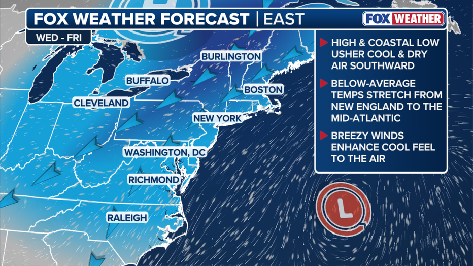
Tuesday, Wednesday, Thursday: As the nor'easter strengthens along the East Coast, expect highs in the mid 60s and windy conditions around the NYC area.
Friday: Parts of southern New Jersey could begin seeing impacts of the low-pressure system.
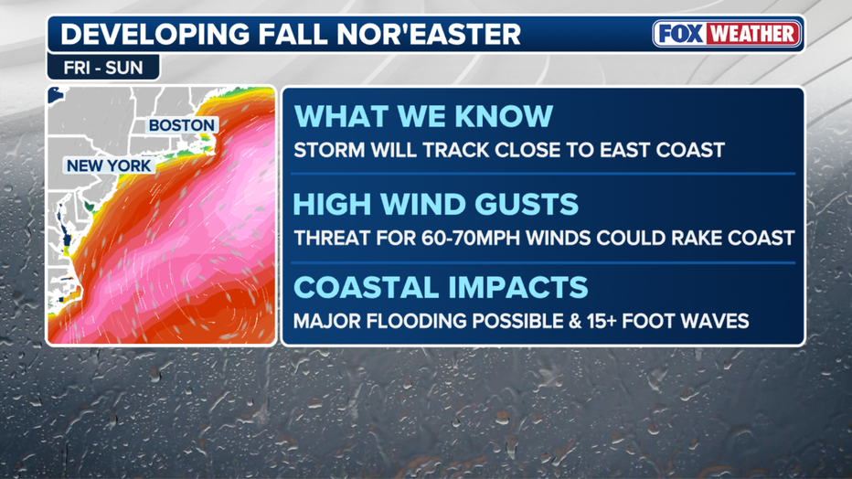
- Compounding tidal flooding and heavy wave action, focused heavily on the southern half of the state.
- Wing gusts in the 30 to 40 mph range, but possibly trending higher if the storm tracks closer to shore.
- Wave heights building to 15 to 18 feet offshore.
- Moderate coastal flooding developing mid-week, with the potential to reach major flood thresholds into the weekend.
- Rainfall, but depending entirely on how far inland the storm tracks.
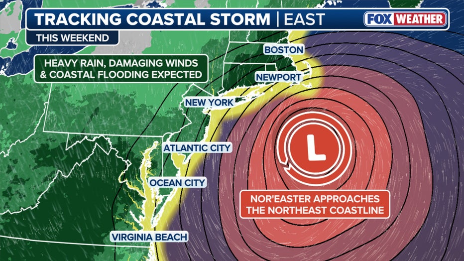
Saturday, Sunday: If the storm shifts closer to New Jersey or Long Island, instead of tracking more toward Boston, the strongest impacts could shift south, putting New York City on the fringe of 60 to 70 mph wind gusts, heavy rainfall and major storm surge.
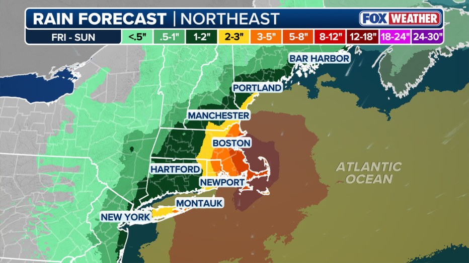
As it stands now, eastern Long Island could see 3" or more of rain, with lighter totals further inland and in Connecticut. However, rain totals could rise if the storm extends further on shore.
NYC, NJ nor'easter impacts
Local perspective:
While the Mid-Atlantic takes the brunt of the storm during the workweek, New York City and Long Island are bracing for a potentially severe weekend. By Thursday and Friday, the surface low will emerge off the coast and begin to rapidly strengthen. The severity of the storm for the five boroughs and Long Island entirely depends on its final track:
- The European Model brings the low closer to the shore as a stronger storm. If the storm shifts closer to New Jersey, NYC will be directly in the path for heavy rain, 50 mph wind gusts, and major storm surge.
- The GFS Model keeps the low farther out to sea. If this happens, New York City will largely remain on the outskirts of the storm, experiencing breezy conditions and some rain, but avoiding the worst of the flooding.
Regardless of the final track, forecasts agree that persistent waves and high astronomical tides will cause significant dune damage and structural flooding along Long Island and Queens coastlines.
Breaking down the scenarios
What we don't know:
The FOX Forecast Center said there are a few scenarios that could unfold as the storm moves north.
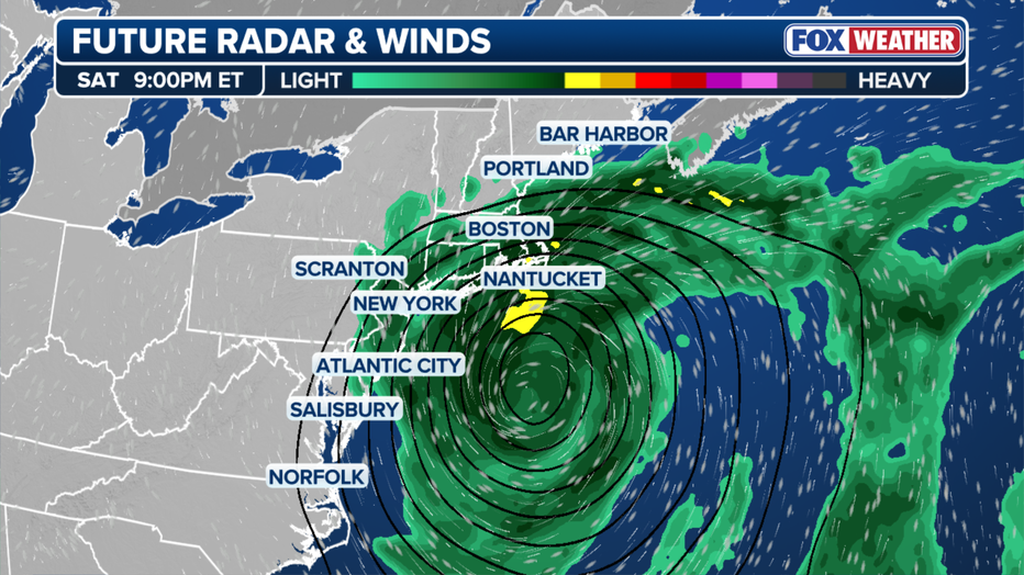
One scenario is if the storm shifts closer to Boston. This could turn the storm into a major weather event, featuring 60 to 70 mph wind gusts, heavy rainfall, major storm surge and significant disruptions to Boston Harbor and the Massachusetts coastline.
On the other hand, if the storm shifts closer to New Jersey or Long Island, the strongest impacts could shift farther south, potentially putting New York City on the fringe of the storm.
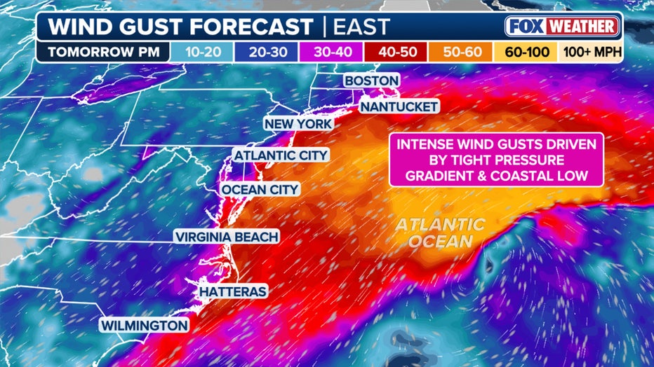
If the area of low pressure remains offshore, coastal New England could still experience rough surf, elevated tides and breezy conditions, while the heaviest rain and strongest winds remain displaced to the south and east over open water.
The Source: This article includes information from FOX Weather and FOX 5 NY meteorologist Mike Woods.