

Weather Forecast
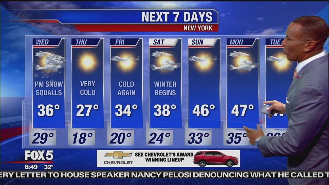
Meteorologist Mike Woods says we'll start off with dry, yet potentially icy conditions across the region as yesterday's storm exits the area. Look for a mixed sky with passing snow showers and squalls this afternoon as a blast of Arctic air moves through. This will set us up for a very cold Thursday, however temperatures will recover as we get into the weekend.
Meteorologist Mike Woods says we'll start off with dry, yet potentially icy conditions across the region as yesterday's storm exits the area. Look for a mixed sky with passing snow showers and squalls this afternoon as a blast of Arctic air moves through. This will set us up for a very cold Thursday, however temperatures will recover as we get into the weekend.

Weather Forecast
Audrey Puente has the latest forecast. She says to expect some more rain and freezing rain.
Audrey Puente has the latest forecast. She says to expect some more rain and freezing rain.

Weather Forecast
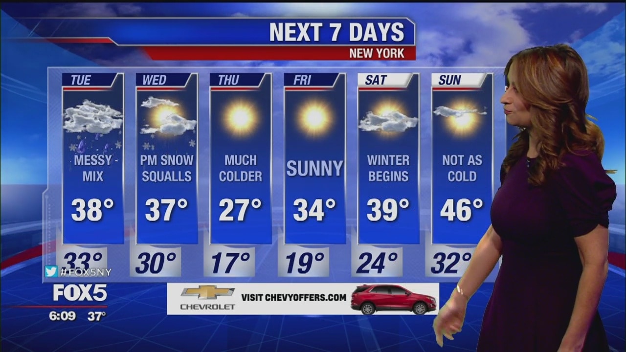
Meteorologist Mike Woods says snow and ice will accumulate to the north and west of the Metro area, especially in the higher elevations. The storm will move out Tuesday night, but we may have some icy conditions as temperatures drop below freezing. Much colder air will be overtaking the region over the next couple of days.
Meteorologist Mike Woods says snow and ice will accumulate to the north and west of the Metro area, especially in the higher elevations. The storm will move out Tuesday night, but we may have some icy conditions as temperatures drop below freezing. Much colder air will be overtaking the region over the next couple of days.
Weather Forecast
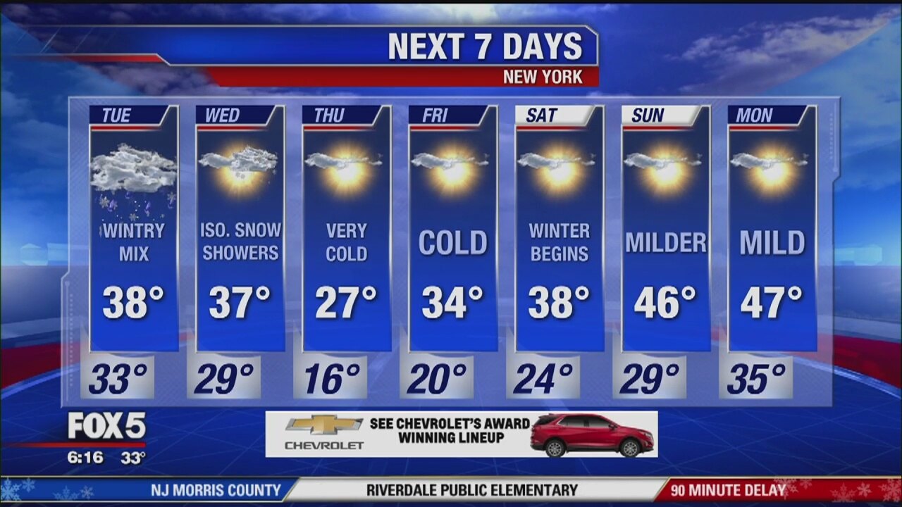
A wintry mix is working it's way through the Tristate region giving us plenty of slick travel in the morning. Snow and ice will accumulate to the north and west of the metro areas, especially in the higher elevations. The storm will move out tonight but we may have some icy conditions as temperatures drop below freezing. Much colder air will be overtaking the region over the next couple of days.
A wintry mix is working it's way through the Tristate region giving us plenty of slick travel in the morning. Snow and ice will accumulate to the north and west of the metro areas, especially in the higher elevations. The storm will move out tonight but we may have some icy conditions as temperatures drop below freezing. Much colder air will be overtaking the region over the next couple of days.

Weather Forecast
Audrey Puente says you can expect icy road conditions on Tuesday due to snow and freezing rain.
Audrey Puente says you can expect icy road conditions on Tuesday due to snow and freezing rain.
Weather Forecast
Audrey Puente has the weather.
Audrey Puente has the weather.

Weather Forecast
Mike Woods has the latest on the storm.
Mike Woods has the latest on the storm.
Weather Forecast
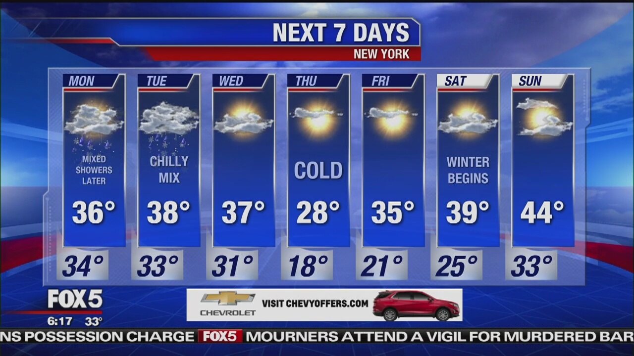
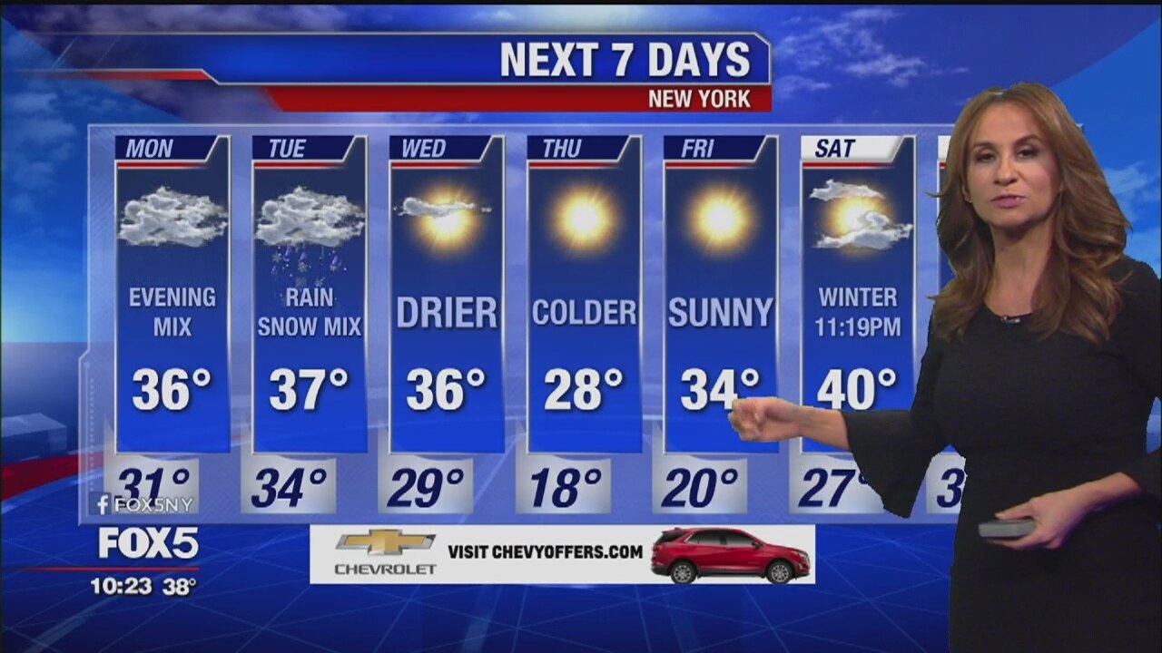
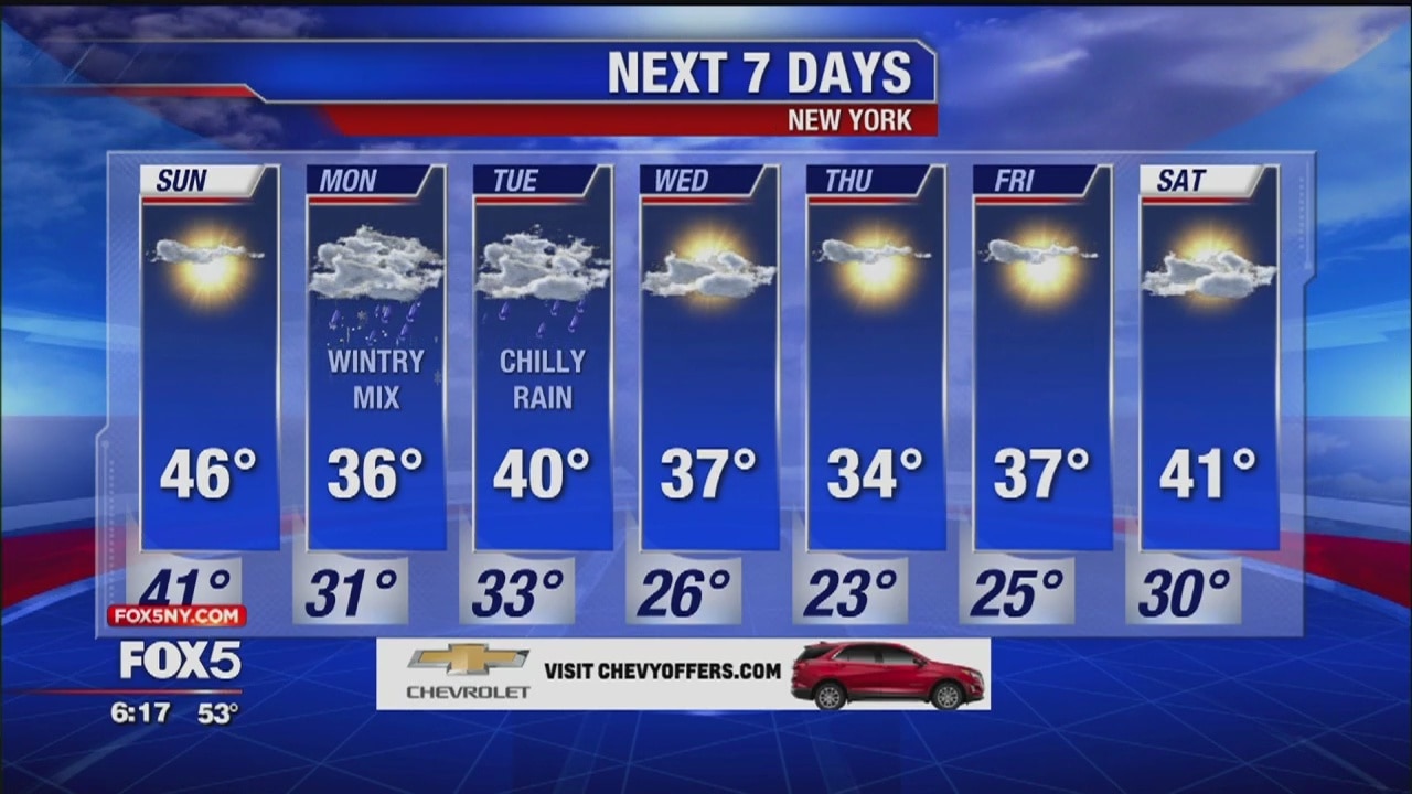
Clouds will thicken around the Tristate with mixed showers breaking out later in the afternoon and into the evening. There will be some minor accumulations from 1-3" possible to the north and west, especially in the higher elevations. Most of the metro area will see a chilly rain starting later Monday through Tuesday followed by more cold weather for the end of the week.
Clouds will thicken around the Tristate with mixed showers breaking out later in the afternoon and into the evening. There will be some minor accumulations from 1-3" possible to the north and west, especially in the higher elevations. Most of the metro area will see a chilly rain starting later Monday through Tuesday followed by more cold weather for the end of the week.
Weather forecast
Audrey Puente has your weather forecast.
Audrey Puente has your weather forecast.
Weather forecast
Mike Woods has your weather forecast.
Mike Woods has your weather forecast.

Weather Forecast
Nick Gregory has the weather.
Nick Gregory has the weather.
Weather Forecast
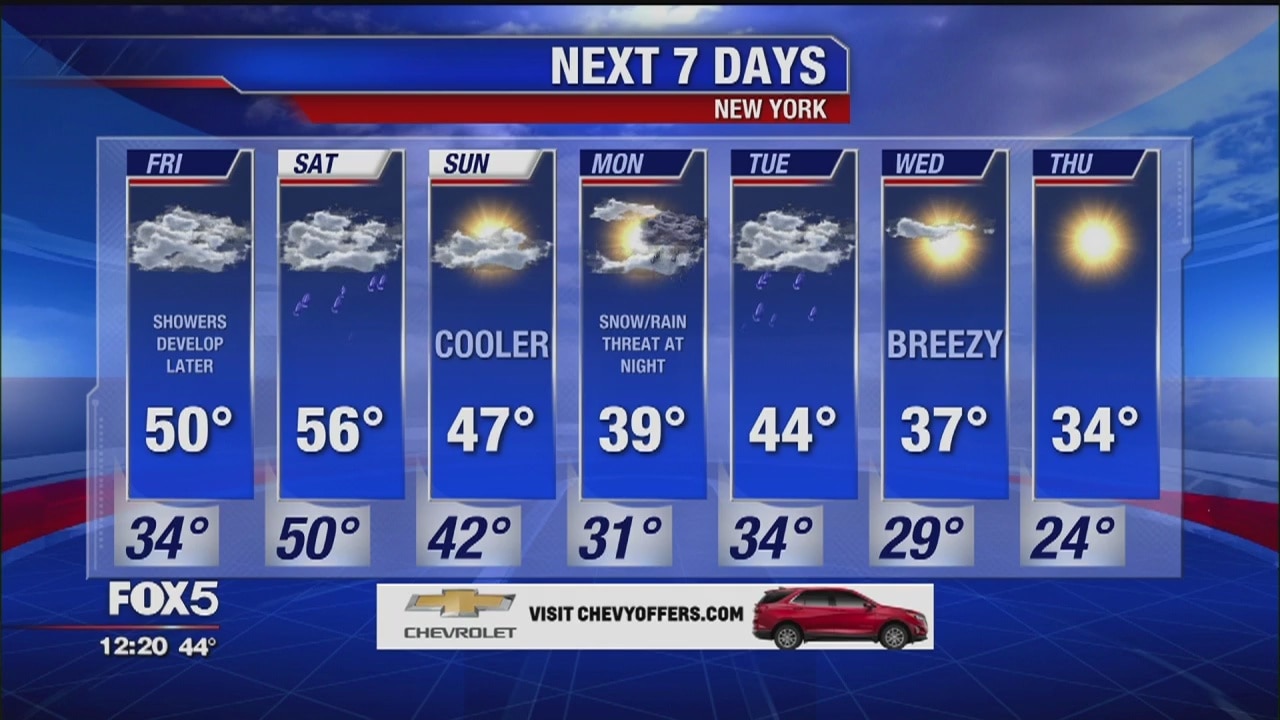
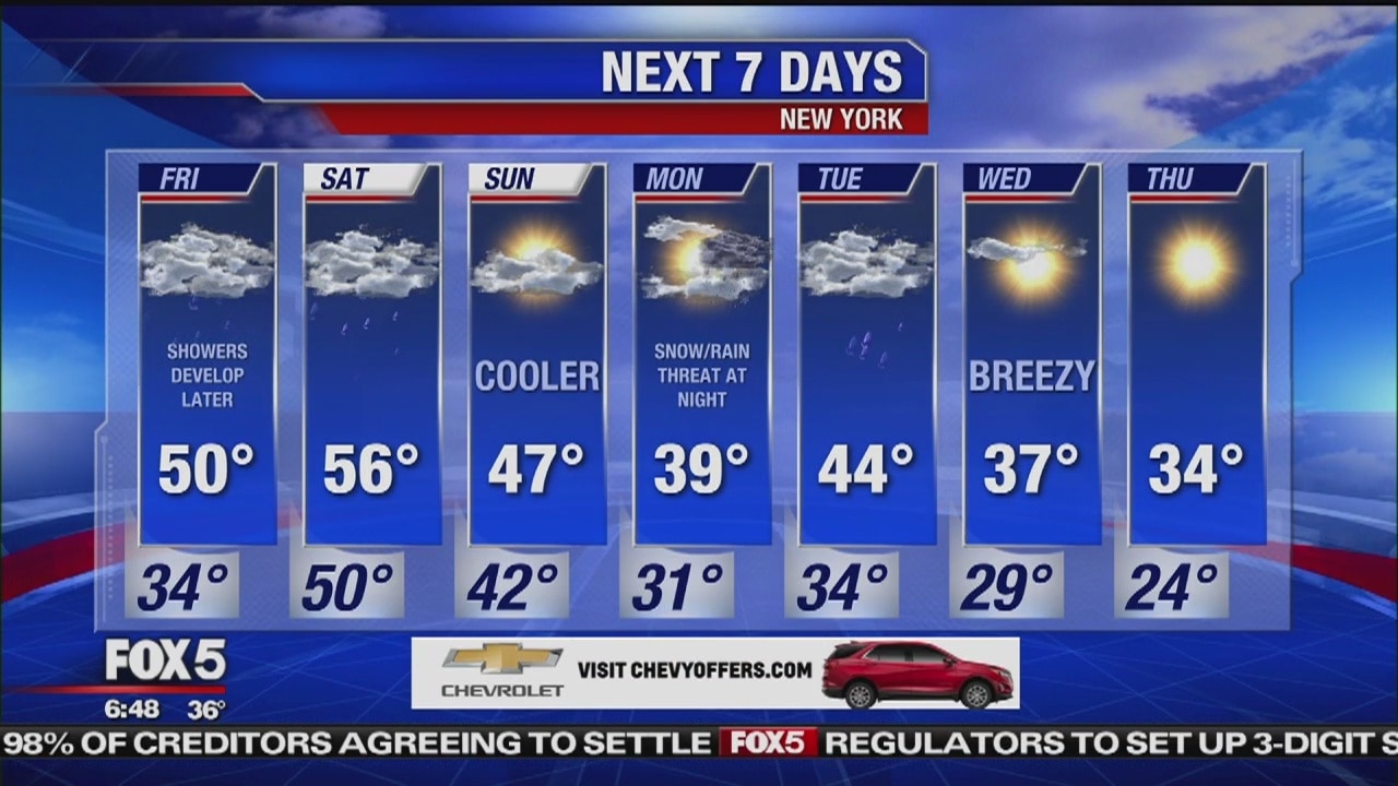
Clouds are building back into the region as a storm takes shape in the southeast. We'll see thickening clouds Friday with showers developing throughout the day. The rain intensity picks up this evening into Friday night with some heavy rain moving through overnight. Temperatures will rebound into an above normal range for the next couple of days before cooler air returns early next week.
Clouds are building back into the region as a storm takes shape in the southeast. We'll see thickening clouds Friday with showers developing throughout the day. The rain intensity picks up this evening into Friday night with some heavy rain moving through overnight. Temperatures will rebound into an above normal range for the next couple of days before cooler air returns early next week.
Weather Forecast
Mike Woods has your weather forecast.
Mike Woods has your weather forecast.

Weather forecast
Nick Gregory has your weather forecast.
Nick Gregory has your weather forecast.
Weather Forecast
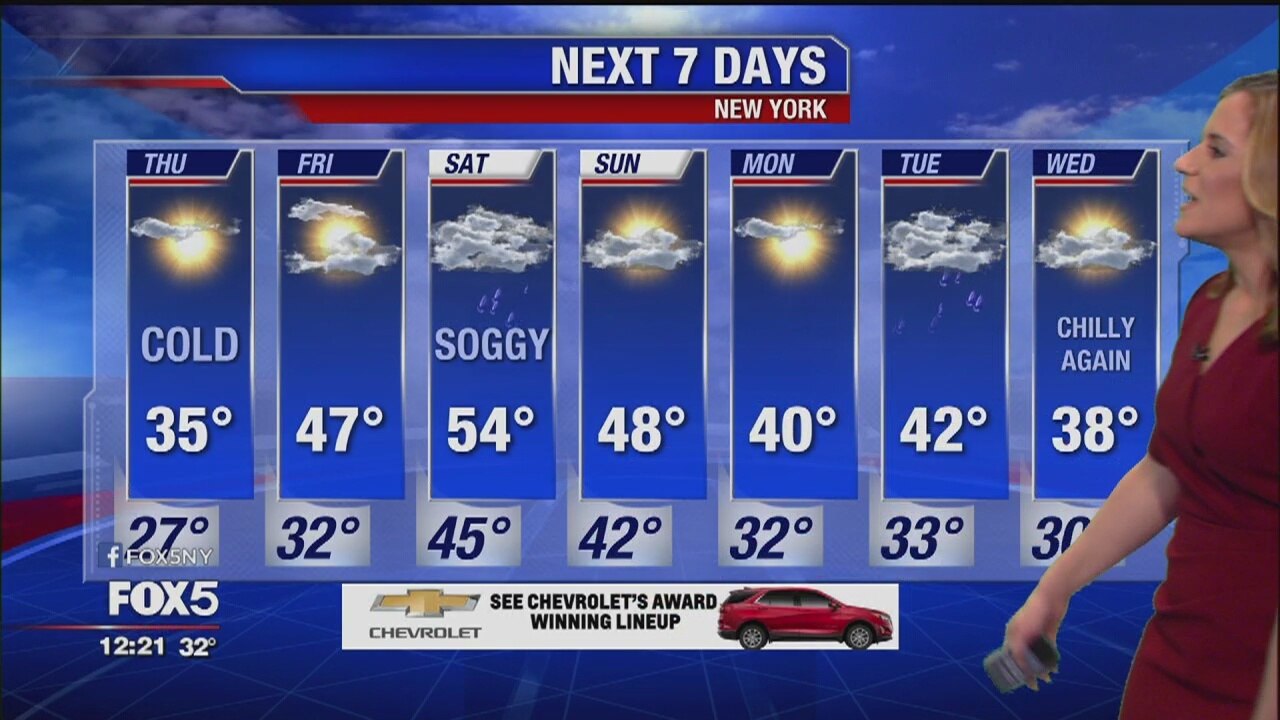
Clouds will begin to roll back in tonight but showers should hold off until Friday evening. The weekend still looks like it will start of quite wet.
Clouds will begin to roll back in tonight but showers should hold off until Friday evening. The weekend still looks like it will start of quite wet.
Weather Forecast
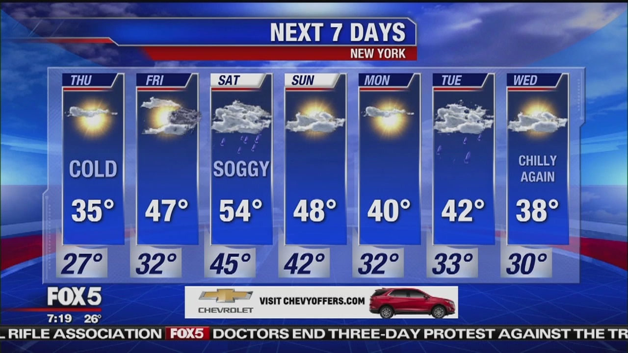
After a very chilly start, we'll see plenty of sunshine Thursday. Our temperatures will be limited to the mid-30s this afternoon. Clouds begin to roll back in Thursday night but showers should hold off until Friday evening. The weekend still looks like it will start off quite wet.
After a very chilly start, we'll see plenty of sunshine Thursday. Our temperatures will be limited to the mid-30s this afternoon. Clouds begin to roll back in Thursday night but showers should hold off until Friday evening. The weekend still looks like it will start off quite wet.
Weather forecast
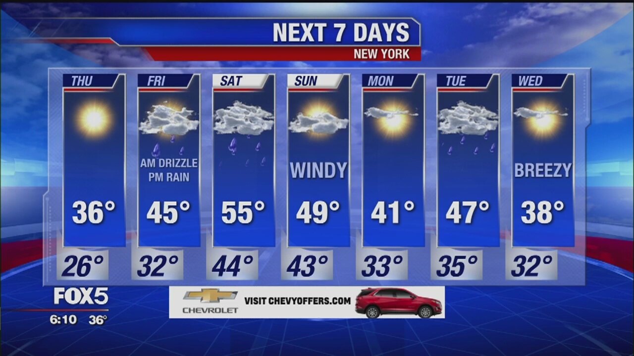
Nick Gregory has your weather forecast.
Nick Gregory has your weather forecast.
Weather Forecast
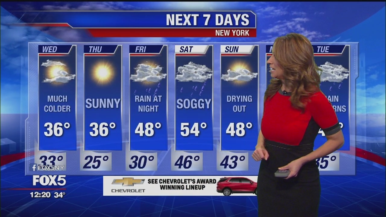
Sun will break out Wednesday afternoon then the cold weather will take over for a couple of days. The weekend is still looking a somewhat soggy.
Sun will break out Wednesday afternoon then the cold weather will take over for a couple of days. The weekend is still looking a somewhat soggy.

Weather Forecast
The rain is changing to snow this morning which will bring us a slippery commute. Snow accumulations will be in the neighborhood of 1-3" before it all leaves the area by mid day. Sun will break out this afternoon then the cold weather will take over for a couple of days. The weekend is still looking a somewhat soggy.
The rain is changing to snow this morning which will bring us a slippery commute. Snow accumulations will be in the neighborhood of 1-3" before it all leaves the area by mid day. Sun will break out this afternoon then the cold weather will take over for a couple of days. The weekend is still looking a somewhat soggy.

Weather Forecast
Audrey Puente has an update on the cold front.
Audrey Puente has an update on the cold front.